Introduction
GPS solved outdoor navigation. It didn't solve the harder problem: what happens the moment you step inside. Modern buildings are larger, more complex, and more operationally demanding than at any point in history.
Hospitals cover millions of square metres across dozens of wards and departments. University campuses span hundreds of buildings. Manufacturing sites contain thousands of individually catalogued assets. Airports process hundreds of thousands of passengers daily through multi-level terminals that reconfigure between seasons.
Yet most people navigating these environments still rely on the same tools they used thirty years ago: static signage, printed maps, and asking someone who happens to know the building.
Indoor navigation has grown up. Modern indoor navigation systems now sit at the intersection of wayfinding, accessibility, operations, safety, workplace experience, and spatial computing. The technology is no longer the limiting factor. The challenge is knowing which approach fits your environment, your users, and your operational model, then deploying it in a way people actually use.
This guide covers everything: how indoor navigation works, the technologies involved, the trade-offs between them, and how to build a business case, evaluate vendors, and get a deployment right. It's written for facilities leaders, estates teams, workplace experience managers, accessibility leads, operations teams, IT and security stakeholders, and anyone buying or evaluating indoor navigation technology.
Key takeaways
Here are five key things you should know about indoor navigation:
- 1. Poor indoor navigation has a measurable operational cost. In US hospitals alone, staff lose an estimated 98 million hours annually to wayfinding assistance — equivalent to 51,072 full-time nursing positions. Every complex environment has its equivalent. (SAGE Journals, 2025)
- 2. GPS stops at the door. People spend 87% of their time indoors, yet GPS — the technology that transformed outdoor navigation — can't reliably work inside a building. Indoor navigation requires a completely different approach. (NHAPS / Lawrence Berkeley National Laboratory)
- 3. For visitor-facing deployments, app-free access isn't optional. Around 46% of app installs are uninstalled within 30 days. Asking a patient, visitor, or event attendee to download an app before they can navigate is a barrier most won't cross. (AppsFlyer, 2025)
- 4. Accessibility is a design requirement, not a feature. 16.1 million people in the UK (around 1 in 4) live with a disability. An indoor navigation system that doesn't work for blind, low-vision, or wheelchair users actively excludes a significant share of your visitors and staff. (Gov.UK, 2024)
- 5. No single positioning technology is best for every environment. Trade-offs between accuracy, cost, maintenance, and accessibility should drive technology selection, not familiarity or what a vendor defaults to.
What is indoor navigation?
Indoor navigation uses digital technology to guide people through the interior of a building or complex. Unlike outdoor GPS, it provides turn-by-turn directions, searchable destinations, and real-time routing across rooms, floors, corridors, and spaces where satellite signals can't reliably reach.
Indoor navigation vs GPS
GPS works by triangulating signals from satellites orbiting the Earth. It's highly effective outdoors in open sky conditions, typically achieving accuracy of 5 to 10 metres (Pointr, 2024).
Indoors, satellite signals are blocked or severely distorted by walls, roofs, floors, steel, glass, and concrete. GPS accuracy degrades to 30 to 100 metres indoors, or becomes entirely unusable. That means a GPS-based system can't tell whether you're in one ward or the next, on this floor or the one above.
Indoor navigation uses alternative positioning systems, covered in detail in the next section, to determine your location inside a building without relying on satellite signals.
What does turn-by-turn navigation mean indoors?
Turn-by-turn navigation indoors works the same way as driving directions: the system knows where you are, knows where you want to go, calculates the optimal route, and delivers turn-by-turn instructions as you move.
The difference is the complexity of the environment. Indoors, a route must account for:
- 1. Multiple floors connected by stairs, lifts, or ramps
- 2. Doors, corridors, and restricted areas
- 3. Dead ends, security checkpoints, and access-controlled zones
- 4. Walkable versus non-walkable areas
- 5. Accessibility constraints such as step-free routes or wide-aisle requirements
Good indoor navigation systems model all of this within a navigable map called a navigation mesh: a digital representation of every route a user can legitimately take.
Indoor navigation vs indoor wayfinding
These terms are often used interchangeably, but there's a useful distinction.
Indoor wayfinding is the broader challenge of helping people orient themselves and navigate a building. It encompasses signage, maps, staff assistance, landmarks, and any other cues that help people navigate.
Indoor navigation is the specific, technology-enabled implementation of wayfinding: a system that uses positioning, routing, and real-time guidance to deliver turn-by-turn directions.
| Workflow Area | Indoor wayfinding | Indoor navigation |
|---|---|---|
| Includes signage | Yes | Not necessarily |
| Requires technology | No | Yes |
| Provides turn-by-turn directions | No | Yes |
| Updates in real time | No | Yes |
| Can be used without local knowledge | Partially | Yes |
| Accessible to screen readers | Only with audio signage | Potentially, if designed inclusively |
Why is indoor navigation difficult?
The challenge of indoor navigation is more technical than it first appears. Outdoors, GPS provides a universal positioning signal that any device can receive. Indoors, there's no equivalent universal standard.
Every indoor environment is different. A hospital has different constraints to a factory, a museum, or an airport. Walls, floors, lifts, security zones, dynamic equipment, and temporary changes all affect how a positioning system performs.
This is why indoor navigation isn't a single solved problem with one obvious answer. It's a category of solutions, each with different strengths, trade-offs, and appropriate environments.
Why doesn't GPS work indoors?
GPS signals come from satellites roughly 20,000 kilometres above the Earth. Buildings, particularly those with concrete, steel, or reinforced structures, block or severely attenuate those signals. Indoors, GPS accuracy degrades from around 5-10 metres outdoors to 30-100 metres or worse, making it unreliable for room-level navigation in most buildings.
The physics of satellite signals
GPS works by receiving signals from a constellation of satellites. Your device calculates its position by measuring the time it takes signals to arrive from at least four satellites. The more satellites visible, and the stronger the signal, the more accurate the result.
Buildings disrupt this in three main ways:
- 1. Signal blockage: Concrete floors, reinforced walls, steel structures, and glass all block satellite signals before they reach your device. In underground spaces, below-grade car parks, or densely constructed buildings, GPS signal may be entirely unavailable.
- 2. Signal reflection (multipath): Even where signals penetrate, they bounce off internal surfaces and arrive at your device from multiple angles. This multipath effect distorts the timing calculation, degrading accuracy significantly.
- 3. Signal attenuation: Signals that do reach your device indoors are often so weakened that the position fix is unreliable, even if technically available.
Multi-floor complexity
GPS has no reliable way to determine altitude with useful precision at the building scale. Even if a GPS fix is available inside a multi-storey building, it can't tell you which floor you're on.
A hospital with 12 floors presents GPS with an insurmountable problem: it can't distinguish floor 3 from floor 7, or the basement car park from the ground-floor reception. Indoor navigation systems address this by using technologies that provide floor- or room-level accuracy.
The time indoors problem
People spend approximately 87% of their time inside enclosed buildings, and a further 6% in enclosed vehicles (NHAPS / Lawrence Berkeley National Laboratory). That means GPS, the navigation technology that's been normalised over the past two decades, is simply irrelevant for the majority of daily human movement.
Indoor environments are where people get lost, miss appointments, waste time searching for rooms, and struggle to find equipment, colleagues, or services. It's a significant gap, and it's why the indoor location market is now a multi-billion-pound sector.
What indoor navigation needs instead
Because GPS cannot reliably penetrate buildings, indoor navigation relies on alternative positioning technologies:
- 1. Radio signals from beacons, Wi-Fi access points, or UWB anchors
- 2. Visual positioning using camera images matched to a spatial map
- 3. QR codes or NFC tags that anchor a user's position at known points
- 4. Inertial sensors that track movement relative to a known starting point
- 5. Combinations of the above, used in parallel to improve accuracy and reliability
Each of these is explored in the next section.
What are the main types of indoor navigation technology?
An indoor positioning system forms the foundation of any indoor navigation deployment. The indoor positioning market contains a wide range of technologies, and no single approach is universally best. Each technology suits different environments, use cases, and budgets. Understanding the trade-offs is essential for choosing the right approach.
Indoor technology comparison table
Compare every type of indoor navigation technology using the comparison table below. This isn't an exhaustive list, but it should give you a good understanding of the different types of technology available to you, their use cases and where they're typically deployed.
| Technology | Accuracy | Best for | Hardware? | App required? | Maintenance burden | Accessibility fit |
|---|---|---|---|---|---|---|
| BLE Beacons | 1-3m | Retail, hospitals, campuses | Yes | Often, yes | Medium (battery, firmware) | Medium |
| Wi-Fi positioning | 5-15m | Coarse navigation, large open spaces | No (uses existing APs) | Often, yes | Low–Medium | Low (accuracy limits) |
| Visual Positioning System (VPS) | Sub-metre | Complex multi-floor, AR guidance | No (scan required) | No (browser possible) | Medium (re-scanning) | High (with audio layer) |
| Ultra-wideband (UWB) | 10-30cm | Manufacturing, clinical asset tracking | Yes (anchors + tags) | Sometimes | High | Low for consumer use |
| RFID and NFC | Point-fix only | Check-in, asset tag | Passive tags | No | Very low | Medium |
| QR-code-based positioning | Point-fix only | Low-cost, any environment | No | No | Very low | Medium |
| Inertial (PDR) | Drifts over time | Supplement to other methods | No | Yes | None | Medium |
| 2D map-based navigation | N/a | Simple buildings, map-literate users | No | Sometimes | Low (map updates) | Low |
| 3D digital twin navigation | N/a | High-value visitor environments | No | Yes | High | Medium |
| AR indoor navigation | Depends on positioning | Complex environments, visitor experience | No | No (browser possible) | Medium | High (with audio layer) |
BLE Beacons
How it works: Small battery-powered transmitters broadcast Bluetooth Low Energy signals. Devices detect nearby beacons and estimate position by measuring signal strength (RSSI) from multiple beacons, a process called trilateration.
- Strengths: Relatively low cost per unit. Widely understood. No user action required for detection.
- Weaknesses: Accuracy is typically 1 to 3 metres under standard BLE, and can degrade in environments with interference, signal reflection, or human obstruction. Requires physical installation and ongoing battery maintenance. BLE 5.1 with Angle of Arrival (AoA) can achieve sub-metre accuracy, but requires directional antenna arrays.
- Best-fit environments: Retail, airports, hospitals, campuses, anywhere with stable infrastructure and a managed maintenance schedule.
- Maintenance: Batteries require replacement every 1 to 5 years, depending on beacon type. Firmware updates may be needed. Physical repositioning required if layout changes.
- Cost/complexity: Medium hardware cost, significant installation cost in large buildings, moderate ongoing maintenance overhead.
- Accessibility: Passive detection means users don't need to take any action. Works with screen reader flows if the application is designed to support them.
Wi-Fi positioning
How it works: Estimates position using the signal strength of nearby Wi-Fi access points. A fingerprinting approach maps signal patterns at known locations, then matches real-time readings to the map.
- Strengths: Uses existing infrastructure where Wi-Fi access points are already deployed. No additional hardware required in some environments.
- Weaknesses: Typical accuracy of 5 to 15 metres, too coarse for room-level navigation in dense environments. Susceptible to interference, and fingerprint maps require re-calibration when the environment changes. AP placement is optimised for coverage, not positioning.
- Best-fit environments: Coarse-level navigation in large, open spaces where room-level accuracy isn't critical.
- Maintenance: Low hardware overhead if existing APs are used, but the fingerprint database needs updating when layouts change.
- Cost/complexity: Low if infrastructure exists. Moderate recalibration effort.
- Accessibility: Similar to BLE: passive for the user, but accuracy limitations affect the reliability of instructions.
Visual Positioning Systems (VPS)
How it works: A device's camera captures the environment and sends that image to a VPS engine, which compares it against a pre-built 3D map of the space. That map is constructed beforehand using reality capture tools: LiDAR scanners, smartphones, 360-degree cameras, or photogrammetry rigs. The engine identifies distinctive visual features in both the live image and the stored map, matches them, and returns the device's precise position and orientation in six degrees of freedom (6-DoF): where it is in space and which way it's facing.
- Strengths: Delivers far higher accuracy than GPS, Wi-Fi, or beacons, and works in complex indoor environments where those alternatives either fail or require significant hardware. The 3D map acts as a persistent spatial layer: AR content, navigation overlays, and digital twin data can be anchored to it and remain accurate across multiple users and devices. Leading providers like MultiSet cite sub-5cm accuracy and localisation times under 100ms under controlled scanning conditions; typical production deployments, where lighting, occlusion, and scan freshness vary more, are more realistically sub-metre, still an order of magnitude ahead of BLE or Wi-Fi.
- Weaknesses: Requires upfront mapping effort before deployment. Performance degrades in visually uniform spaces (long identical corridors, blank walls) and in low light, though newer systems have improved significantly on both fronts. Maps need refreshing when the physical environment changes substantially.
- Best-fit environments: Any GPS-denied space that needs precise, persistent AR: manufacturing facilities, warehouses, hospitals, airports, retail, stadiums, construction sites.
- Maintenance: Re-map when the space changes significantly. Better platforms version maps so existing anchors and AR content survive a re-scan without needing to be rebuilt.
- Cost/complexity: Medium to high mapping effort depending on space size and scan quality required. Low hardware cost, as it runs on any camera-equipped device. Cloud, on-device, or private deployment options exist.
- Accessibility: Camera-dependent, so only accessible to users with a compatible device and application. App-free implementations like Zapworks Spaces reduce friction by removing the need to install a dedicated app.
Ultra-wideband (UWB)
How it works: Uses short radio pulses across a wide frequency band to measure time-of-flight between anchor points and tags. UWB achieves typical accuracy of 10 to 30 centimetres.
- Strengths: The most accurate indoor positioning technology available at scale. Excellent for asset tracking, safety-critical environments, and precision navigation. Resistant to multipath interference.
- Weaknesses: Higher hardware cost. Requires dense anchor installation. Users or assets typically need to carry a UWB-compatible tag or device. Not universally supported on consumer smartphones (though iPhone 11 onwards includes UWB chips, software support varies by application).
- Best-fit environments: Manufacturing, industrial facilities, hospitals (clinical asset tracking), warehouses, research labs.
- Maintenance: Hardware-dependent. Anchors require installation and periodic calibration.
- Cost/complexity: High hardware cost. High installation complexity. High accuracy.
- Accessibility: Currently limited for general consumer accessibility use cases, as it often requires dedicated hardware tags.
RFID and NFC
How it works: RFID (Radio Frequency Identification) and NFC (Near Field Communication) use radio signals to read or interact with passive tags. NFC requires close proximity, a few centimetres. RFID can work at greater ranges depending on frequency.
- Strengths: Very low cost per tag. NFC is built into most smartphones. Useful for anchoring a user's position at a specific point.
- Weaknesses: Doesn't provide continuous positioning. Useful only as position-fixing points, not for real-time tracking as users move.
- Best-fit environments: Asset tracking, maintenance workflows, check-in points, fixed navigation anchors.
- Maintenance: Tags are largely maintenance-free. Reader infrastructure requires maintenance.
- Cost/complexity: Low cost per tag. Moderate infrastructure for active RFID.
- Accessibility: NFC can support accessible navigation by anchoring users at known points, but requires the user to actively tap the tag.
QR-code-based positioning
How it works: QR codes are placed at known locations throughout a building. When a user scans a code, the system registers their position and calculates a route from that anchor point.
- Strengths: Very low cost. No hardware infrastructure beyond the printed codes. No battery maintenance. Easy to update. Works on any device with a camera.
- Weaknesses: Not continuous: position is only known at the moment of scanning. Accuracy depends entirely on QR code placement. Codes can be damaged, removed, or obscured.
- Best-fit environments: Any environment, particularly as a cost-effective starting point or supplement to other positioning methods. Works well in museums, warehouses, and large campuses.
- Maintenance: Low. QR codes are cheap to replace or relocate.
- Cost/complexity: Very low cost. Very low maintenance. Accuracy limited to anchor point locations.
- Accessibility: Requires a camera action from the user. May present challenges for users with low vision, though some implementations support NFC tags at the same positions.
LiDAR and spatial scans
How it works: LiDAR (Light Detection and Ranging) uses laser pulses to create precise 3D point clouds of a space. Camera-based scanning tools (such as those in apps like the Matterport Pro series) create photorealistic 3D models. These scans serve as the base layer for indoor navigation systems.
- Strengths: High-fidelity spatial representation. Can be used as the foundation for VPS, digital twins, and navigation mesh generation.
- Weaknesses: The scan itself doesn't provide navigation. It must be processed to extract walkable areas, routes, destinations, and landmarks. Scanning takes time and skill. Updates require re-scanning.
- Best-fit environments: Any environment where a high-quality spatial reference is needed.
- Maintenance: Rescanning required when physical layout changes.
- Cost/complexity: Scanning cost varies by provider and environment size. Professional scanning of a large facility can be significant.
- Accessibility: Enables accessibility-aware mapping (step-free areas, ramps, lifts) if accessibility data is annotated during the authoring phase.
2D map-based navigation
How it works: A 2D floor plan is overlaid with a user's position and a calculated route. The interface looks similar to a standard map application, but constrained to the building interior.
- Strengths: Familiar interface. Easy to understand at a glance. Low device requirements.
- Weaknesses: Doesn't communicate the physical environment. Users can't see where doors, obstacles, or landmarks are. Route following relies on the user interpreting a map accurately. Can be disorienting in unfamiliar, complex buildings.
- Best-fit environments: Simple buildings with clear layouts. Suitable where users are already comfortable with map reading.
- Maintenance: Map updates required when layouts change.
- Cost/complexity: Low to medium. Well-understood technology.
- Accessibility: Map-reading requires spatial reasoning. Not well-suited to blind or low-vision users without significant additional design work.
3D digital twin navigation
How it works: A 3D model of the building is used as the navigation surface. The user sees their position and route in a three-dimensional view that more closely represents what they will see in the real world.
- Strengths: More immersive and legible than a 2D map. Can show floor connections, obstacles, and spatial relationships more intuitively.
- Weaknesses: More complex to build and maintain. Higher device requirements. Can be overwhelming in dense environments.
- Best-fit environments: High-value visitor environments, training, onboarding, or environments where spatial understanding is particularly important.
- Maintenance: 3D model updates required when layouts change.
- Cost/complexity: High initial build cost. Medium ongoing maintenance.
- Accessibility: Can support accessible routing if accessibility data is built in, but the visual interface itself may not be suitable for low-vision users without alternative output modes.
AR indoor navigation
How it works: Navigation instructions, arrows, route lines, destination markers, breadcrumbs are overlaid onto a live camera view of the real environment. The user follows guidance rendered directly on top of what they can see.
- Strengths: Highly intuitive. Users follow guidance in the context of the physical environment. Reduces the cognitive load of interpreting a map. Particularly useful in environments where routes aren't otherwise marked. Can use VPS for accurate positioning.
- Weaknesses: Requires a camera-equipped device. Not suitable as the sole navigation mode for blind or low-vision users. Battery and performance-intensive. Can feel disorienting in environments with poor visual distinctiveness.
- Best-fit environments: Airports, museums, large campuses, corporate offices, anywhere with high spatial complexity and strong visual distinctiveness.
- Maintenance: Requires underlying positioning and scan maintenance.
- Cost/complexity: Medium to high, depending on the underlying positioning approach.
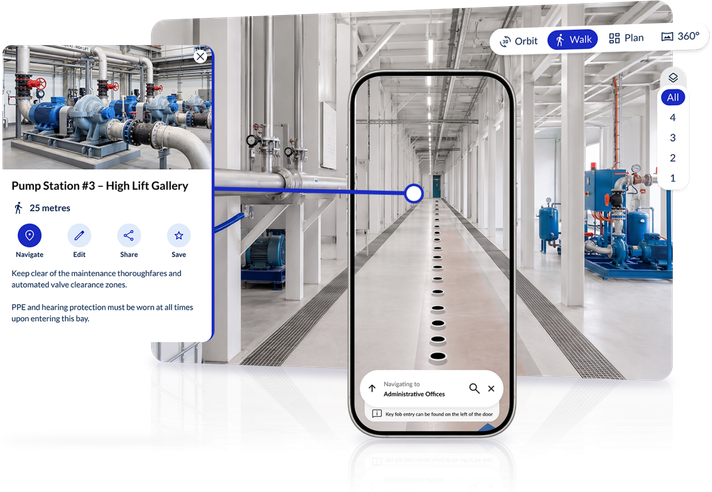
- Accessibility: AR overlays should always be supplemented with audio guidance and screen-reader-compatible text alternatives, so that sighted and non-sighted users can share the same navigation experience. This is the approach we've taken with Zapworks Spaces, offering turn-by-turn navigation for blind, low-vision and sighted users within the same shared experience.
Why hybrid approaches help
Many production indoor navigation systems combine VPS with at least one other positioning method. A QR scan can anchor the user's starting position precisely before VPS takes over. Beacons can serve as additional reference points when visual matching is uncertain. Inertial sensors can smooth out positioning between VPS frames. The result is a system that's more robust across a wider range of environmental conditions.
We take a similar approach with Zapworks Spaces, combining VPS from the likes of MultiSet with our Accessible QR codes, this enables smoother re-localisation when there are no identifying features from the initial scan for the VPS to accurately localise a device (and user) within a space.
What is VPS and why does it matter?
A Visual Positioning System (VPS) uses camera images to determine a user's position and orientation by matching visual features in the live camera view against a pre-built 3D spatial reference map of the environment. Unlike GPS, it works indoors and provides both position and heading data without additional hardware infrastructure.
How does VPS work?
When a user holds up their phone camera, the VPS system analyses the image and compares it against a spatial reference map, typically built from LiDAR scans, photogrammetric scans, or structured-light captures of the building. The system identifies visual landmarks, textures, edges, and spatial relationships in the image, then matches these against the reference to calculate where the user is and which way they're facing.
This is computationally intensive, but modern devices and cloud-processing pipelines handle it efficiently enough for real-time navigation use.
How VPS differs from GPS
GPS uses satellite signals and triangulation. VPS uses computer vision and spatial matching. GPS provides position only (latitude, longitude, and approximate altitude). VPS provides position plus orientation. The system knows not just where you are, but which way you're facing. That's what makes AR guidance overlays possible: the system can calculate exactly where to place a direction arrow in your camera view.
How VPS differs from QR or beacon systems
QR codes and beacons provide discrete position fixes at specific points in a building. VPS provides continuous positioning as the user moves. The position estimate updates with every camera frame. This continuous positional awareness enables smoother, more natural navigation guidance. Instead of "walk to the next QR code and scan it," the system can say "continue straight for 20 metres, then turn left."
Where VPS can struggle
VPS relies on visual distinctiveness. Environments where every corridor looks the same, identical ceiling tiles, uniform walls, no visual landmarks, make it harder for the system to match camera frames to the reference map reliably. This is where the hybrid approach mentioned above comes in. Highly dynamic environments can also create challenges. If a large piece of equipment is moved, a temporary partition is erected, or a section of a warehouse is reorganised, the reference map may no longer match the real environment. This is why VPS systems need to be kept current, and why hybrid approaches that supplement VPS with QR anchors or beacons can be valuable in dynamic spaces.
Why hybrid approaches help
Many production indoor navigation systems like Zapworks Spaces combine VPS with at least one other positioning method. A QR scan can anchor the user's starting position precisely before VPS takes over. Beacons can serve as additional reference points when visual matching is uncertain. Inertial sensors can smooth out positioning between VPS frames. The result is a system that's more robust across a wider range of environmental conditions.
What is AR indoor navigation?
Augmented reality indoor navigation overlays digital guidance, arrows, route lines, destination markers, points of interest, breadcrumb trails, onto a live camera view of the real environment. Instead of following a route on a map, the user follows visual cues rendered directly on top of what their phone camera sees.
How AR navigation guidance works
An AR navigation system combines a positioning method (typically VPS, with optional beacon or QR supplementation) with an AR rendering layer. The system:
- 1. Determines the user's position and orientation using the camera
- 2. Calculates the route from current position to destination
- 3. Renders guidance markers, arrows, route lines, destination icons, distance labels, that appear to sit in the real physical environment
- 4. Updates continuously as the user moves
This creates a more intuitive navigation experience than a 2D map for many users. Instead of mentally translating a top-down map view into the real environment in front of them, users can simply follow the arrow they see overlaid on the corridor ahead.
Where AR guidance works really well
AR navigation is particularly effective in:
- Complex multi-floor environments where spatial reasoning is difficult
- Unfamiliar environments such as first-time hospital visits, conference venues, or large campuses
- Environments with limited signage or confusing layouts
- High-value visitor experiences such as museums, galleries, or heritage sites
Where AR should be used carefully
AR navigation is not universally appropriate. In environments with high foot traffic and narrow corridors, asking people to walk while looking at their phone can create safety issues. In environments with poor lighting, AR overlays may be hard to see clearly. In environments where every corridor looks visually identical, VPS may struggle to provide the accurate positioning that AR guidance requires.
AR navigation should always be considered alongside, not instead of, audio guidance and accessible alternatives. An AR arrow that sighted users find intuitive is useless to a blind user. The most effective AR navigation implementations treat the AR overlay as one of several output modes, not the only one.
App-free AR navigation
Until recently, AR indoor navigation typically required downloading a native app. Browser-based AR capabilities have improved significantly, but the two mobile ecosystems support it very differently, so the most reliable app-free platforms use different delivery methods for iOS and Android rather than a single browser-based approach everywhere.
Zapworks Spaces uses the approach best suited to each platform. On iOS, where Safari's WebXR support remains limited, Spaces delivers native-quality AR via App Clip: a lightweight native experience launched instantly from a QR code or link, with no App Store visit required. On Android, where Chrome's WebXR support is mature, Spaces delivers AR navigation directly in the browser via WebXR, again with no app download. Either way, users start navigating by scanning a QR code or following a link. This app-free approach is particularly valuable for visitor-facing deployments where app download friction is a significant adoption barrier.
AR navigation and accessibility
AR overlays should not come at the expense of accessibility. The most inclusive approach is to design a navigation experience where:
- Sighted users can follow AR overlays
- Low-vision users can use high-contrast visual guidance
- Blind users can follow audio turn-by-turn instructions via their screen reader
- All three groups are navigating the same destinations, routes, and environment
This is genuinely achievable in a well-designed system. It requires deliberate design choices, not just an AR layer with audio bolted on afterwards.
Key use cases for indoor navigation
Indoor navigation isn't a single use case. The problems it solves differ substantially depending on the environment, the users, and the operational context. This section covers the major use cases in detail.
Indoor navigation for hospitals and healthcare environments
The navigation problem: Hospitals are among the most complex buildings in the world. Departments move. Wards are reconfigured. Temporary clinics appear and disappear. Signage is often outdated before it is even printed.
Over 85% of patients ask for directions when visiting a hospital or public health facility, and 30% of first-time visitors get lost (Gozio Health, 2023–24).
Why traditional approaches struggle: Physical signage can't keep pace with a dynamic healthcare environment. Staff become de facto wayfinding assistants, diverting time and attention from clinical duties. A 2025 peer-reviewed study found that US hospital staff collectively lose an estimated 98 million nurse hours annually to wayfinding assistance, equivalent to 51,072 full-time nursing positions (SAGE Journals, 2025).
The operational cost of poor hospital wayfinding
The cost is not just staff time: 8.1 million NHS outpatient appointments were missed in England in 2024-25. At an estimated cost of £160 per missed appointment, the potential annual cost to the NHS is between £1.25 billion and £1.9 billion (NHS England Digital, 2025). Poor wayfinding doesn't cause all missed appointments, but it's a documented contributing factor for first-time and infrequent visitors.
What effective hospital navigation looks like: Patients and visitors scan a QR code at the entrance, search for their ward, department, clinic, or pharmacy, and follow step-by-step directions from wherever they're standing. Step-free routes are searchable, not just theoretically available. When a department moves, the system updates in minutes. Staff locate equipment and assets without calling a colleague who happens to know the building.
Key outcomes:
- Clinical staff stop escorting lost visitors. Those hours go back to patient care.
- First-time visitors reach appointments on time and independently, including patients with visual or mobility impairments who previously needed a staff escort.
- Directional queries at main reception drop noticeably, typically within days of launch.
- Estates teams update wayfinding information digitally when departments move, without reprinting signage or waiting for a contractor.
- Accessibility audits become demonstrably easier to pass. Step-free routes are mapped, tested, and searchable.
Example destinations: Wards, departments, clinics, pharmacy, X-ray, phlebotomy, café, accessible toilets, lifts, main reception, discharge lounge, A&E, chapel, car park, maternity, NICU, critical care.
Pilot starting point: A phased pilot almost always outperforms a full rollout in healthcare. Here's a practical starting path:
- 1. Pick one entry point and one destination cluster. Main entrance to outpatient clinics, pharmacy, and X-ray is a strong first scope. These are typically the top three requests to any NHS reception desk. A single-floor pilot covering these destinations is testable within weeks.
- 2. Build your destination list from reception staff, not IT. They know what's asked 50 times a day. Capture the top 30 destinations before you touch a floor plan. This list shapes your spatial scan and POI setup.
- 3. Scan the space. A photogrammetric scan of a typical hospital wing takes a trained operator a few hours. Plan for access approval with infection control and estates ahead of the scan date.
- 4. Test on a real clinic day before expanding. Give patients a QR code at the entrance during a scheduled outpatient session. Observe, collect feedback, and fix what's confusing before rolling out to the wider site.
Note: App-free delivery is almost always the right choice for hospital environments. Asking a stressed patient to download an app before they can find cardiology is a barrier most won't cross.
Discover how you can deploy Zapworks Spaces for your hospital or healthcare estate.
Manufacturing and industrial facilities
The navigation problem: Manufacturing sites and industrial facilities contain thousands of individually catalogued assets, valves, pumps, electrical panels, safety equipment, machinery, spread across large, physically complex environments. Technicians and contractors need to find specific assets quickly and accurately.
Why traditional approaches struggle: Asset location relies on local knowledge. New technicians and contractors can't find assets without being escorted. Asset management systems contain location data, but navigating to that location indoors isn't supported.
What effective industrial navigation looks like: A maintenance technician searches for valve HV-234 or fire extinguisher zone B7 and follows turn-by-turn directions from their current location. Contractors navigate independently on their first visit without needing an escort. Safety-critical assets, eyewash stations, first aid kits, emergency shutoffs, are findable by anyone in seconds, not just experienced staff.
Key outcomes:
- New contractors navigate independently from day one. Experienced staff stop losing time to escort duties.
- Maintenance response time to specific assets drops. Engineers arrive at the right location on the first attempt.
- Safety asset location time decreases significantly. In an emergency, this matters.
- Health and safety compliance becomes demonstrable. You can show that any person on site can find a fire extinguisher or first aid point within seconds, not minutes.
- When plant layouts change, the navigation system updates to reflect the new configuration rather than pointing people to where things used to be.
Example destinations: Plant rooms, electrical panels, valves, pumps, fire extinguishers, eyewash stations, first aid points, emergency exits, loading bays, offices, welfare facilities, control rooms, specific machinery.
Pilot starting point:
- 1. Map safety-critical assets first. Fire extinguishers, eyewash stations, first aid kits, emergency shutoffs, AEDs. This is your strongest pilot scope: it's immediately justifiable, it has a clear compliance angle, and it affects everyone on site.
- 2. Work from your asset management system. If you have a CAFM or EAM system with location data, your navigation vendor should be able to ingest that data and place POIs on the floor plan. This is faster than manually cataloguing every asset.
- 3. Test with a new contractor before going wider. Give a contractor who has never visited the site a task: find asset X. Time it. Ask them where they got confused. This surfaces navigation gaps faster than any internal test.
- 4. Plan for dynamic areas separately. Areas where equipment moves frequently (production lines, staging areas) may need QR anchor points rather than VPS, since the spatial scan can become outdated. Identify these zones before the pilot.
Discover how you can deploy Zapworks Spaces at your factory or industrial facility.
Retail and shopping centres
Who this is for: Centre management, retail tenants, marketing teams, and facilities.
The navigation problem: Large shopping centres, hypermarkets, and multi-level retail parks are difficult to navigate, particularly for infrequent visitors. Anchor store locations, parking validation points, and food courts are common sources of confusion.
Why traditional approaches struggle: Physical kiosks are expensive to maintain and concentrated at key entry points. Retailer apps rarely cover the full centre. Dynamic seasonal changes affect the usefulness of static maps.
What effective retail navigation looks like: Shoppers search for a specific retailer, brand, toilet, ATM, or click-and-collect point and are navigated there from their current location on any floor. Seasonal changes and new tenants update in the system quickly. Retailers in harder-to-find locations become discoverable rather than invisible to anyone who doesn't already know they're there.
Key outcomes:
- Wayfinding queries to information points and security staff drop.
- Retailers in lower-traffic locations see more footfall as they become searchable and navigable.
- Visitor dwell time increases. People who can find what they're looking for stay longer and visit more of the centre.
- Accessibility routes are mapped and available, including lift locations, accessible toilets, and step-free access between floors.
- Tenant changes, seasonal reconfiguration, and temporary closures update in the system without reprinting physical maps.
Example destinations: Individual retailers, ATMs, toilets, food court, click-and-collect points, car parks, lifts, escalators, accessible routes.
Pilot starting point:
- 1. Start with one floor and the most common destinations. Toilets, ATMs, the food court, and the top 10 retailers by query volume. This is testable in a few weeks and gives you a clear proof of concept.
- 2. Get retailer data in order early. Tenant names, unit numbers, and categories are the foundation of your POI layer. If this data is messy or out of date, clean it before you scan. Bad data in means bad navigation out.
- 3. Identify your distribution method. QR codes at entrances, at car park exits, or embedded in the centre app are all options. Choose one for the pilot and measure engagement before adding more channels.
- 4. Measure footfall to harder-to-find units during the pilot. If indoor navigation increases footfall to units that were previously navigable only by people who already knew where they were, that's a compelling commercial case for full rollout.
Discover how you can deploy Zapworks Spaces for commercial real estate and shopping centres.
Corporate offices and workplace campuses
Who this is for: Workplace experience managers, facilities management, IT services, reception and visitor management teams, HR and onboarding leads.
The navigation problem: Large corporate campuses, particularly multi-building headquarters, financial district towers, or sprawling tech campuses, present significant navigation challenges for visitors, contractors, new starters, and staff who rarely visit other buildings in the estate.
Why traditional approaches struggle: Room booking systems change which floor a team is on. Hot-desking policies mean there's no fixed desk to navigate to. Visitor management is complex when visitors need to find the right meeting room in a building they've never been to.
What effective workplace navigation looks like: Visitors receive a calendar invite with a link that opens navigation directly to their meeting room. Contractors find the server room, comms riser, or plant room without calling facilities. New starters explore the building before their first day. Hot-desking environments become navigable because the system reflects current team locations, not last year's seating plan.
Key outcomes:
- Visitors arrive at meeting rooms without calling reception or getting a staff escort.
- Contractors operate independently from their first visit. Facilities teams stop spending time on escort duties.
- New starter onboarding time shortens. People feel confident in the building within days rather than weeks.
- Facilities support tickets related to "where is X?" drop measurably.
- Workplace experience scores improve. The building feels well-run rather than confusing.
Example destinations: Meeting rooms, hot desks, team areas, café, gym, roof terrace, bike store, shower rooms, IT support, first aid, fire exits, accessible routes, post room.
Pilot starting point:
- 1. Start with the visitor journey. Reception to the most common meeting rooms is the highest-friction path and the most visible quick win. Map it, test it, and get it right before expanding.
- 2. Connect it to your calendar system. A meeting invite that includes a navigation link is a significant improvement for visitor experience. Most indoor navigation platforms support this integration; treat it as a day-one requirement, not a nice-to-have.
- 3. Identify the 20 destinations contractors most commonly need. Server rooms, plant rooms, comms risers, roof access, loading bays. These are often not on standard visitor floor plans. Get them mapped.
- 4. Measure baseline first. Count how many times reception or facilities fields a "where is X?" call in a typical week before launch. That number becomes your before/after metric.
Museum wayfinding: museums, galleries, and cultural venues
The navigation problem: Cultural institutions face a particular challenge: they want visitors to explore and discover, not just move efficiently. Navigation needs to support both the serendipitous visitor and the visitor with a specific destination in mind.
Why traditional approaches struggle: Paper maps are often ignored. Static signage is hard to update when exhibitions change. Tour guides are expensive to scale. Accessibility is frequently an afterthought.
What effective museum navigation looks like: Visitors search for a specific exhibit, artist, or gallery and are guided there efficiently, with rich content available at the destination if the platform supports it. Pre-planned tour routes are navigable. Accessible routes are clearly available. When an exhibition changes or a gallery is temporarily closed, the navigation reflects that immediately, not after the next map reprint.
Key outcomes:
- Visitor satisfaction scores improve. People find what they came for without frustration, and discover things they didn't expect to.
- Staff handling directional queries at the entrance and information points spend less time on basic navigation and more time on meaningful visitor interaction.
- Dwell time increases as visitors navigate to more of the building rather than staying in the zones they can find intuitively.
- Accessibility routes are mapped and tested, not assumed. Visitors with mobility or visual impairments navigate independently.
- Exhibition changes and temporary gallery closures update in the system quickly, without requiring physical signage reprints.
Example destinations: Galleries, exhibits, café, shop, toilets, lifts, accessible entrance, cloakroom, events space, group meeting points, specific artworks.
Pilot starting point:
- 1. Start with your most-asked-for destinations. Ask information desk staff what they're asked most. The top 20 answers become your first POI list. This is almost always more useful than starting from a floor plan.
- 2. Map one floor or one gallery wing first. A single-zone pilot is testable quickly and gives you real visitor feedback before you invest in mapping the full building.
- 3. Test the exhibition change workflow before launch. Museums and galleries are dynamic environments. Make sure your team knows how to update POIs when exhibitions change, and that the process is simple enough to actually happen. If updating a POI requires a support ticket, it won't happen.
- 4. Treat accessible routing as a first-class pilot requirement. Don't test it as an afterthought. Include a wheelchair user and a visitor with visual impairment in your pilot group and observe how the system performs for them.
Universities and campuses
The navigation problem: Universities are small cities. Prospective students navigate unfamiliar campuses during open days and interviews and new students start each academic year without knowing where their lectures are. Researchers and visiting academics move between labs, departments, and facilities.
What effective campus navigation looks like: Students search for their lecture theatre, seminar room, or lab and get accurate turn-by-turn directions including which floor, which corridor, which entrance. Open day visitors navigate unfamiliar buildings without needing a student ambassador at every junction. Students with disabilities find step-free routes and accessible facilities independently, without having to ask.
Key outcomes:
- Wayfinding queries to reception, security desks, and student services drop in the first weeks after launch.
- Open day visitor experience ratings improve. Prospective students and parents spend less time lost and more time engaging with the campus.
- New starters navigate independently from their first week, without relying on a classmate who happens to know the building layout.
- Disability and inclusion teams can demonstrate accessible routes are mapped, tested, and working, not just assumed.
- Estates teams update room names and department locations digitally when faculties reorganise, without reprinting maps.
Example destinations: Lecture theatres, seminar rooms, labs, libraries, student union, health centre, student support services, accessible entrances, bike storage, print rooms, departmental offices.
Pilot starting point:
- 1. Use open day or freshers week as your forcing function. These events have real deadlines, identifiable users, and immediate feedback. A successful open day pilot gives you a clear win and a case for wider rollout.
- 2. Pick one building or campus zone to start. The main teaching building or the one that generates the most wayfinding queries is a good choice. A single-building pilot is completable in a matter of weeks.
- 3. Build your destination list with student services. They log what students ask for. Use that data to define your first 30 POIs, not a facilities floor plan that lists every storage cupboard.
- 4. Run a soft launch with a single cohort. Give QR codes or a link to a specific tutorial group or visiting day group. Gather feedback before opening it to the whole campus.
Accessibility and inclusive indoor navigation
Indoor navigation is an accessibility issue, not just an operational one. For a significant proportion of the population, navigating unfamiliar indoor environments without support is genuinely difficult or impossible without appropriate technology. 16.1 million people in the UK, around 24% of the population, have a disability (Gov.UK, 2024). Globally, approximately 2.2 billion people have some form of visual impairment (WHO, 2024). For these users, the difference between an accessible and an inaccessible indoor navigation system isn't a matter of convenience. It's a matter of independent access.
How inclusive design benefits all users
Accessibility design principles benefit a far wider population than those with permanent disabilities. A visitor walking through a busy hospital corridor can't look at their phone while carrying bags. Audio guidance helps them. A contractor in a noisy industrial environment can't easily follow AR overlays. Clear landmark-based audio instructions help them. A first-time visitor to an unfamiliar building lacks spatial context. Pre-arrival route review helps them.
Good accessibility design is good design.
Comparing accessible indoor navigation solutions
This table compares six accessible indoor navigation platforms; Zapworks Spaces, Lazarillo, GoodMaps, Waymap, NaviLens and Right-Hear across positioning technology, routing capability, and disability support. It's worth noting that most sight-loss-focused solutions aren't built for wheelchair users; only Waymap and Zapworks Spaces combine full routing with tested step-free routing.
| Platform | Positioning tech | Routing type | App required? | Blind/low-vision | Wheelchair routing | Venue deployment | Cost model |
|---|---|---|---|---|---|---|---|
| Zapworks Spaces | Visual Positioning System (VPS) from 3D scan | Full route | App-free (browser/QR) | Spoken turn-by-turn | Yes — tested with users | Scan space, add POIs, publish link | Pricing on request |
| Lazarillo | BLE beacons, LiDAR scan, 5G (indoor); GPS (outdoor) | Full route | Native app | Turn-by-turn audio | Not stated | Venue scans space, installs beacons w/ Lazarillo | Free app; paid venue plans |
| GoodMaps | LiDAR scan + camera positioning | Full route | Native app | Purpose-built | Not stated | LiDAR scan only, no fixed hardware | Free app; venue pricing on request |
| Waymap | Phone sensors (dead-reckoning); no GPS/BLE/Wi-Fi | Full route | App, web, or embedded | Audio instructions | Yes — incl. hospitals | CAD drawings; 4–6 wk build | SaaS (venue pays); free for users |
| NaviLens | Proprietary colour-matrix codes, camera-read | Orientation | Native app (+ GO app) | Audio + haptic | N/A — marker-based | Install codes at each POI | Free app; venue code kits/quote |
| Right-Hear | BLE beacons at "Accessible Spots" | Orientation | Native app | 360° audio | Not stated | Install + program beacons via dashboard | Not disclosed; contact for pricing |
Blind and low-vision navigation
For blind and low-vision users, audio-based turn-by-turn navigation is the primary interface.
This means:
- Directions must be delivered in clear, plain language via a screen reader or built-in text-to-speech
- Distance cues must be accurate and meaningful ("turn left in 15 metres", not "turn left at the end")
- Landmarks must be audible, not just visual ("pass through the glass doors", "turn right at the lift lobby")
- Positioning must be accurate enough to give directional instructions without requiring the user to look at a screen
The camera-based interface used by many AR navigation systems, including our own Zapworks Spaces isn't appropriate as the sole interface for blind users. However, the underlying VPS and routing capabilities of an AR system can absolutely support audio-based navigation for screen reader users, provided the application is designed to deliver audio output, not only visual AR overlays.
Screen-reader compatibility
Screen reader compatibility is non-negotiable for inclusive indoor navigation.
This requires:
- All navigation instructions delivered as accessible text that screen readers can read aloud
- No instructions are conveyed only through colour or visual icons
- Interactive elements (search, destination selection, route start) are operable via voice control and switch access
- Compatible with VoiceOver (iOS) and TalkBack (Android)
Step-free routing
For wheelchair users and those with mobility impairments, step-free routing is essential. This means the navigation system must:
- Know which routes involve stairs (and exclude them by default, or by user preference)
- Know the locations of lifts, ramps, and accessible corridors
- Provide step-free routes that may be longer or less direct than the standard route
- Clearly signal when a step-free route is significantly different from the standard route
- Flag when a step-free route is unavailable due to a lift being out of service
Landmark-based guidance
Clear, specific landmarks make navigation easier for everyone, but they're particularly important for blind users who can't see distant visual cues. Good landmark guidance includes:
- Named structural features ("turn right at the double doors")
- Audible cues where available ("turn left after you hear the café")
- Tactile features where relevant ("follow the tactile path to the lift lobby")
- Consistent, unique naming of destinations so users know when they have arrived
Cognitive accessibility
Cognitive accessibility is often overlooked in indoor navigation design. Users with cognitive impairments, autism, anxiety, or dementia may need:
- Simple, unambiguous language (avoid "proceed north-east along the main corridor")
- Fewer instructions at a time
- Clear arrival confirmation ("you have reached your destination")
- The ability to review the full route before starting
- A way to pause or repeat instructions
Planning a route before arrival
Pre-arrival route familiarisation is a significant accessibility benefit that's rarely discussed. A blind or anxious visitor who can review their entire route, from car park entrance to clinic room, before arriving at a hospital is far better prepared for the actual journey. Indoor navigation systems that provide shareable route links enable this capability.
Why separate "accessibility modes" are problematic
Many early indoor navigation systems added an "accessibility mode" as a bolt-on feature. This approach creates two separate experiences: one for "standard" users and one for "accessibility" users. It's both architecturally inefficient and socially problematic.
The better approach is to design one shared navigation experience that works for all users. Sighted users follow AR or map-based guidance. Low-vision users follow high-contrast visual guidance. Blind users follow audio guidance. All three groups are navigating the same destinations, along the same routes, in the same environment. Zapworks Spaces is designed around this principle: one shared navigation experience that supports blind, low-vision, wheelchair, and sighted users without requiring them to use a different product or a parallel system.
App-based vs app-free indoor navigation
One of the most consequential decisions in any indoor navigation deployment is whether users are expected to download a native app, or whether they can access navigation through a browser, QR code, or App Clip. This isn't a purely technical decision. It has direct implications for adoption, accessibility, and the populations you can realistically serve.
The friction problem with app downloads
Around 46% of app installs are uninstalled within 30 days (AppsFlyer, 2025). These numbers are significant and they're representative of visitors, patients, contractors, students, event attendees and members of the public who have no existing relationship with your organisation and no particular reason to install yet another app. For internal audiences, permanent staff who will use the system daily, native app adoption is more viable. For external audiences, visitors, patients, contractors, temporary staff, event attendees, the download requirement is a significant and often fatal barrier to adoption.
Comparing accessible indoor navigation solutions
This table compares six accessible indoor navigation platforms; Zapworks Spaces, Lazarillo, GoodMaps, Waymap, NaviLens and Right-Hear across positioning technology, routing capability, and disability support. It’s worth noting that most sight-loss-focused solutions aren’t built for wheelchair users; only Waymap and Zapworks Spaces combine full routing with tested step-free routing.
| Platform | Positioning tech | Routing type | App required? | Blind/low-vision | Wheelchair routing | Venue deployment | Cost model |
|---|---|---|---|---|---|---|---|
| Zapworks Spaces | Visual Positioning System (VPS) from 3D scan | Full route | App-free (browser/QR) | Spoken turn-by-turn | Yes — tested with users | Scan space, add POIs, publish link | Pricing on request |
| Lazarillo | BLE beacons, LiDAR scan, 5G (indoor); GPS (outdoor) | Full route | Native app | Turn-by-turn audio | Not stated | Venue scans space, installs beacons w/ Lazarillo | Free app; paid venue plans |
| GoodMaps | LiDAR scan + camera positioning | Full route | Native app | Purpose-built | Not stated | LiDAR scan only, no fixed hardware | Free app; venue pricing on request |
| Waymap | Phone sensors (dead-reckoning); no GPS/BLE/Wi-Fi | Full route | App, web, or embedded | Audio instructions | Yes — incl. hospitals | CAD drawings; 4–6 wk build | SaaS (venue pays); free for users |
| NaviLens | Proprietary colour-matrix codes, camera-read | Orientation | Native app (+ GO app) | Audio + haptic | N/A — marker-based | Install codes at each POI | Free app; venue code kits/quote |
| Right-Hear | BLE beacons at "Accessible Spots" | Orientation | Native app | 360° audio | Not stated | Install + program beacons via dashboard | Not disclosed; contact for pricing |
When to use app-free
Zapworks Spaces itself sits in two of the categories compared in the accessibility solutions table above: App Clip on iOS, and browser-based WebXR on Android, rather than an Android Instant App, giving each platform its most capable native-quality AR delivery without an app download. More broadly, app-free access is the right approach when any of the following are true:
- Your primary users are visitors, patients, contractors, or event attendees who have no prior relationship with your organisation
- You cannot rely on users having installed your app before they arrive
- You need to minimise barriers for accessibility users who may not be familiar with your app
- Your navigation content changes frequently and you want to update it without waiting for app store approval
- You want to deliver navigation via a QR code on a poster, a link in an email, or a tap from digital signage
Zapworks Spaces is designed around app-free access: users can access navigation by scanning a QR code or following a link, without downloading a dedicated app. On iOS, this is delivered through App Clip; on Android, through WebXR directly in the browser. This is particularly relevant for healthcare, education, events, and public venue environments where the user population is diverse and unpredictable.
When native apps make sense
A native app approach is more appropriate when:
- Your users are permanent staff who will use the system daily and are required to install the company app
- You need offline access to large maps in environments with poor connectivity
- Your use case requires features that are not yet well-supported in the web
- You are integrating deeply with device hardware, such as UWB positioning or biometric authentication
The hybrid distribution model
Many organisations end up with a hybrid approach: a native app for staff users, with browser or App Clip access for visitors and contractors. That's a reasonable architecture, but it requires managing two access paths, which adds operational complexity.
How indoor navigation systems are set up
Setting up an indoor navigation system is not a purely technical exercise. The most common failure modes, poor adoption, inaccurate routes, and frustrated users trace back to planning decisions made before a single POI is added.
Here's a practical guide to the key steps, with common mistakes at each stage.
Step 1: Define the use case and users
Before choosing any technology, be specific about who will use the system and what they'll be trying to do. A hospital navigation system for patients is different to a maintenance system for technicians, which is different to a visitor experience system for a museum.
Define:
- Who are the primary users? (Visitors, staff, contractors, accessibility users)
- What are they trying to find? (Rooms, assets, people, services, safety equipment)
- How will they access the system? (QR code, link, app, kiosk)
- What are their accessibility needs?
Step 2: Map the environment and audit existing data
Map the physical constraints of your environment:
- Floor count, approximate area, and layout complexity
- Existing Wi-Fi and BLE infrastructure, and connectivity reliability throughout the space
- Areas where installation is restricted (clinical areas, sterile zones, heritage spaces) and privacy-sensitive areas
- Dynamic areas where layout changes frequently
Then collect whatever spatial data already exists:
- CAD or BIM floorplans, and existing 3D scans (Matterport, RealityCapture, etc.)
- Asset registers and CAFM data
- Existing digital wayfinding systems, current signage, and room naming conventions
Step 3: Choose the right positioning approach
Based on your use case, environment, and constraints, select the positioning technology (or combination) that best fits. Refer to the technology comparison table above.
Key decision factors:
- Required accuracy (room-level, corridor-level, asset-level)
- User device type (consumer smartphone, dedicated device)
- Infrastructure installation feasibility
- Maintenance capacity
- App vs app-free access requirement
- Budget
If you don't have a usable scan, capture one that matches your positioning approach: a photogrammetric or structured-light scan for VPS systems, or a simple 2D floor plan for beacon-based ones. That data is then processed into a navigation mesh, the walkable paths a user can actually take, usually via automated generation followed by manual refinement to exclude walls, add doors, and mark restricted areas.
Step 4: Add destinations, POIs, and accessibility annotations
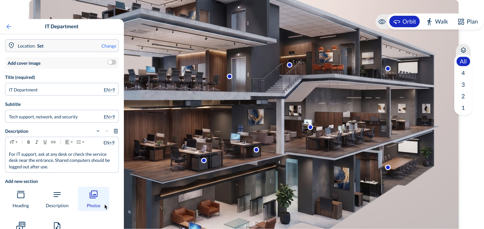
This is where the navigation becomes useful. In Zapworks Spaces we make this incredibly easy through a simple, drag-and-drop interface that anyone on your team can use.
Add:
- Searchable destinations (rooms, departments, assets, services)
- Points of interest (café, toilets, lifts, emergency equipment)
- Categories (so users can browse by type rather than searching by name)
- Named landmarks (to anchor audio instructions)
- Guided routes (pre-defined tours or operational routes)
- Rich content attached to destinations (photos, descriptions, contact information)
Don't leave accessibility for a final phase, annotate it alongside everything else:
- Step-free routes
- Lift locations (and accessible entry points to lifts)
- Ramp locations
- Wide-aisle corridors and accessible toilets
- Any other accessibility-relevant features
Step 5: Configure access and test with real users
Decide which areas of the navigation system should be publicly accessible and which should be restricted:
- Public navigation (any visitor can access)
- Login-protected navigation (staff or registered users only)
- SSO-integrated navigation (access controlled through your organisation's identity provider)
- Partially restricted (public areas accessible, private areas require login)
Sensitive environments, hospitals, factories, and secure campuses typically require a more granular access model than a simple public/private binary.
Then test with real users, non-negotiable, since the most common failure mode is launching a system the development team can use but real users can't:
- Users who have never been to the building before
- Users with accessibility needs (blind, low-vision, wheelchair users)
- Users on the device types and connectivity conditions they will actually have
- Users performing the tasks the system is designed to support
Step 6: Launch, measure, and maintain
For large environments, you should launch in phases: start with a single floor, building, or use case, gather feedback, and fix issues before expanding.
Define success metrics before launch, not after. Aim to track:
- Navigation sessions initiated
- Destinations searched
- Routes completed
- Drop-off points (where users give up)
- Accessibility route usage
- User satisfaction ratings
Indoor navigation isn't a set-and-forget system, buildings change, and navigation must change with them.
Establish a maintenance process:
- A named owner responsible for keeping navigation current
- A process for updating destinations when rooms change
- A process for re-scanning when physical layouts change significantly
- A process for beacon battery replacement if beacons are used
- A regular review cycle (quarterly minimum for active environments)
How accurate does indoor navigation need to be?
When it comes to launching a successful indoor navigation experience, "More accurate is better" isn't always true. The right accuracy level depends entirely on the use case. Pursuing accuracy beyond what a use case requires adds cost and complexity without user benefit.
Comparing accuracy levels: use the below table to compare accuracy levels per use case.
| Accuracy tier | Typical accuracy | Use case |
|---|---|---|
| Room-level | 3–5 m | Most visitor, patient and employee navigation — Wi-Fi, BLE, or moderate VPS |
| Corridor-level | 2–5 m | Long, parallel-corridor environments |
| Shelf-level | 30 cm – 1 m | Retail product location, warehouse picking — BLE 5.1 AoA/AoD, UWB, or high-quality VPS |
| Asset-level | 10–30 cm | Precise maintenance/operational workflows — generally UWB or high-accuracy VPS |
| Safety-critical | Asset-level | Emergency response, lockout/tagout — imprecision here is a safety issue, not just UX |
| Accessibility-focused | 1–3 m | Reliable audio distance cues ("turn left in 15m") for blind users |
Accessible QR codes
Zapworks Spaces supports the use of Accessible QR codes, Zappar's specialist QR codes for blind, low-vision and sighted users that unlock detailed product information via text-to-speech. When combined with Zapworks Spaces, Accessible QR codes enable a new way for people to find specific items, not just rooms.
For example, AQRs let someone scan a code on a moveable item, like a piece of equipment or a product to identify it or get guided straight to it. This means blind and low-vision users can find the exact thing they're looking for, not just the general area it's in.
Common challenges with indoor navigation projects (and how to avoid them)
Indoor navigation projects that succeed tend to solve for the same set of predictable challenges. The ones that fail tend to encounter these challenges without a plan.
- Poor map quality Validate spatial data against the current physical space; recapture if data is 6+ months old or has changed significantly.
- Outdated floorplans Walk the space with the floorplan, mark every discrepancy, update before authoring navigation.
- Dynamic spaces Design for fast, non-technical updates; consider layout-independent QR positioning over VPS in highly dynamic areas.
- Weak connectivity Test connectivity throughout the space; design offline fallback via cached maps, QR anchors, or downloaded routes.
- App download friction Use app-free access for visitor-facing deployments; reserve native apps for staff who can be required to install.
- Beacon maintenance Choose long-battery beacons, create a maintenance schedule, and factor it into total cost of ownership.
- QR marker placement Place codes at eye level, well lit, unobstructed and wheelchair-accessible; test scanning in situ.
- Complex multi-floor routing Model floor transitions explicitly in the mesh; test multi-floor routes physically before publishing.
- Stairs, lifts, ramps & access routes Model step-free and stepped routes separately; test with wheelchair users; flag distance differences.
- Restricted areas Annotate all restricted zones; verify public routes never enter them; access-control sensitive data.
- Security and privacy concerns Understand what's collected and stored; involve security/data-protection teams early.
- Lack of internal ownership Assign a named owner before launch; fold updates into the estate change-management process.
- Overcomplicated pilots Start with one building, floor, or use case; define clear success metrics before scaling.
- Low adoption after launch Make access frictionless — QR at entrances, email links, badges — and act on feedback fast.
- Weak content/POI governance Establish who can add, edit or archive destinations, a naming convention, and a review cycle.
Privacy, security, and data ownership
Indoor navigation raises legitimate privacy and security questions. These questions deserve honest, specific answers, not generic reassurances. Involving your security and data protection team from the start is strongly recommended.
Who owns the map data?
The spatial data that underpins indoor navigation, scan data, floorplans, navigation meshes, destination lists, is operationally sensitive. It describes your building in detail. Organisations should understand:
- Where the map data is stored (cloud infrastructure, on-premise, or private cloud)
- Who has access to the map data (the platform vendor, third-party positioning providers, internal teams)
- What happens to the map data if the vendor contract ends
- Whether the map data is portable: can you export it in a standard format?
Zapworks Spaces supports private hosting options for sensitive environments where organisations need tighter control over where their spatial data is stored.
Where are scans stored?
VPS systems rely on spatial reference data (scan data) being available for position matching. This data is typically stored on cloud infrastructure. In sensitive environments, hospitals, defence sites, government facilities, regulated industries, organisations should ask:
- Is the scan data stored in a specific geographic region?
- Is the scan data encrypted at rest and in transit?
- Can the scan data be stored on our own infrastructure?
- Who can access the raw scan data?
What happens to camera frames?
A common concern with camera-based VPS is whether the camera frames captured by users' devices are stored or transmitted. In well-designed VPS systems, camera frames are processed locally on the device or in the cloud with only positional results returned. The raw frames are not stored. However, implementations vary by provider, and organisations should verify this explicitly with their chosen vendor.
What user data is collected?
Indoor navigation systems may collect:
- Anonymised usage data (which destinations are searched, how many sessions occur)
- Route data (which routes are used, where navigation stops)
- Authentication data (if login-protected access is used)
- Analytics data (dwell time, destination popularity)
Organisations should understand exactly what is collected, how it is stored, and whether it falls within GDPR or other applicable data protection frameworks.
Public vs private spaces
Navigation content for publicly accessible areas of a building (main reception, café, accessible toilets) has different data sensitivity to navigation content for restricted areas (plant rooms, data centres, security access points). A well-designed indoor navigation platform supports granular access control: public navigation is accessible to anyone, while restricted navigation requires authentication.
SSO and access control
Enterprise deployments typically require integration with existing identity providers (Active Directory, Okta, Google Workspace, etc.) so that access to navigation is managed through the same systems as other enterprise applications. SSO support is a standard expectation for enterprise-grade indoor navigation platforms.
Sensitive environments
Healthcare sites, factories, airports, defence establishments, and research facilities have heightened sensitivity around spatial data. The question "can someone use this navigation system to understand the layout of our facility?" is a reasonable security concern.
Practical mitigations include:
- Limiting public navigation content to visitor-relevant areas
- Requiring authentication for staff navigation
- Using private hosting so map data does not leave controlled infrastructure
- Involving security teams in the design of the access model
Why security teams should be involved early
Security teams that are brought in late, after procurement decisions are made, may impose requirements that are difficult to retrofit. Involving them early allows security requirements to inform platform selection and deployment architecture from the start.
Analytics without compromising trust
Usage analytics are valuable for improving indoor navigation systems. But anonymous aggregate data ("200 searches for the pharmacy today") is very different from personal tracking data ("this specific user was in ward 7 for 40 minutes"). Be explicit about what analytics you collect and ensure they align with your privacy commitments and GDPR obligations.
Indoor navigation vendor evaluation checklist
A slick demo tells you almost nothing about how a vendor's system will behave in your building, with your floors, your users, and your existing infrastructure. This checklist is what to ask instead. It covers nine areas: positioning accuracy, accessibility, access model, setup and authoring, maintenance, security and data, integrations, commercial terms, and support. Work through it with every vendor you're considering, and pay close attention to any question they can't answer clearly. That's usually where the real cost shows up later.
Use the checklist below to ensure you're onboarding the right vendor for the job.
-
Accuracy and positioning
- What positioning technology is used, and what's the typical accuracy in your environment?
- Does it support multi-floor navigation, lifts, stairs and ramps?
- What happens when positioning is uncertain or unavailable?
-
Accessibility
- Does the system support screen-reader navigation (VoiceOver / TalkBack)?
- Does the system provide audio turn-by-turn guidance?
- Does the system support step-free routing?
- Are accessibility features tested with real blind, low-vision, and wheelchair users?
-
Access model
- Does the system require users to download an app?
- Is app-free access (browser, App Clip, QR code) supported?
- Does the system support SSO integration?
- Can public and private navigation areas be configured separately?
-
Setup and authoring
- Can destinations/POIs be added without developer involvement?
- How long does initial setup take? Can existing scans be imported?
- Is the authoring tool accessible to non-technical staff?
-
Maintenance
- What happens when the physical layout changes? Full re-scan required?
- How are beacon batteries/hardware maintained?
- What is the process for updating destinations when rooms are renamed?
-
Security and data
- Where is spatial data stored? What user data is collected?
- Is GDPR compliance documented?
- Private/on-premise hosting and data export options available?
-
Integration
- Can the navigation link into calendar systems or visitor management?
- Is there an API for integration with CAFM, IWMS, or asset management systems?
- Can navigation be embedded in an existing intranet, website, or app?
-
Commercial model
- Is pricing based on per-space, per-user, or per-session?
- What is included in the base licence?
- What are the scanning and setup costs?
- What does ongoing maintenance cost?
- Is a proof-of-concept available before full commitment?
-
Support
- What onboarding support is provided?
- Is there a customer success or implementation team?
- What training is available for the authoring team?
How to measure the ROI of your indoor navigation project
Indoor navigation ROI is real, and it's increasingly backed by named, audited deployments rather than vendor promises. The global indoor location market is projected to grow from $14.88 billion in 2025 to $43.32 billion by 2030, a compound annual growth rate of roughly 24% (Mordor Intelligence, 2025). That growth is being driven by organisations that have measured the value of solving indoor wayfinding, not just assumed it. The metrics that matter, and the evidence behind them, vary by environment and use case.
Operational outcomes
Operational metrics are the fastest to build a business case around, because they map onto costs an organisation is already paying: staff hours, response times, onboarding cycles. They're also the ones most likely to have a real precedent, as the case studies below show, healthcare and manufacturing sites have already put hard numbers against most of them.
Reduced time to destination
Track average time from entry to destination before and after deployment. Even a 5-minute reduction per visit represents significant aggregate value in a high-footfall environment.
Reduced wayfinding-related staff diversion
If staff are currently spending time assisting visitors or colleagues with navigation, measure the reduction. In a hospital context, a 2025 peer-reviewed study quantifies this at an equivalent of 51,072 full-time nursing positions across US hospitals annually (SAGE Journals, 2025).
Reduced contractor escort time
In facilities and industrial environments, measure the time spent escorting contractors to assets or locations. Navigation that enables independent access is directly measurable.
Faster maintenance response
Track mean time to reach a work order location before and after navigation deployment. Particularly relevant for safety-critical assets.
Reduced onboarding time
Measure the time from new starter first day to independent navigation capability. Navigation tools that eliminate the "building knowledge" gap have measurable value.
Case study: SEG Automotive
The automotive components manufacturer deployed a UWB real-time location system (40 anchors and 600 tags across a 2,000m² facility, via Sewio) to track metal pallets and materials through production, replacing manual searching and paperwork. The result was a 50% reduction in lead times, elimination of manual picking errors, and roughly 15% of staff reallocated from locating materials to higher-value work, with the positioning system running at 99.9% reliability. (Sewio)
Visitor experience outcomes
Visitor experience metrics are harder to isolate from other causes, but they carry real financial and reputational weight, particularly in healthcare. Use them alongside the operational numbers above rather than as a stand-alone justification, since they're often the outcome of the same underlying change.
Reduced missed appointments: In healthcare, track Did Not Show (DNA) rates for patients who have used navigation versus those who have not. 8.1 million NHS outpatient appointments were missed in England in 2024-25 (NHS England Digital, 2025).
Case study: University Hospitals of Leicester NHS Trust
Wayfinding accounted for roughly 80% of the questions directed to hospital help desks before the Trust trialled Wi-Fi and RTLS-based wayfinding (via Mazemap, with four kiosks and QR-code routing) between August 2024 and March 2025. "Did Not Attend" appointments for wayfinding-related ("other") reasons fell by roughly 19%, from 141 in October 2024 to 114 in November, saving £4,320 in that first month against a baseline DNA cost of around £112,000 a month. Kiosks were used nearly 1,400 times over December and January combined, and the Trust estimated 40-plus staff hours a week freed from wayfinding assistance, with a targeted £672,000 in annual savings from the combined effect. (NHS England Digital, 2025)
Poor wayfinding is a documented contributing factor for first-time and infrequent visitors, not the sole cause of missed appointments; the Leicester case study above shows one Trust isolating and measuring its share of that effect directly.
Improved first-time visitor confidence
Measure visitor satisfaction for first-time visitors specifically, before and after deployment. In a 2025 peer-reviewed evaluation of a browser-based hospital wayfinding tool covering five floors and 758 routes, 87% of participants reported reduced navigation time and 83.3% reported reduced psychological stress compared with unassisted wayfinding, and 94.4% preferred it to traditional signage (PMC, 2025).
Reduced reception and help desk queries
Track wayfinding-related queries at reception desks and help desks. A reduction directly frees reception staff for higher-value tasks. Wayfinding made up roughly 80% of help desk call volume at University Hospitals of Leicester before its pilot, a useful reference point for sizing this metric in a hospital of comparable size.
Improved accessibility satisfaction
Survey users with accessibility needs on their navigation experience. This is both a quality-of-service metric and a compliance metric.
Content and experience metrics
- Navigation sessions initiated: The basic engagement metric. How many times is the system used?
- Most searched destinations: Reveals which destinations are hardest to find with existing signage, and prioritises content investment.
- Navigation drop-off rate: At what point in a route do users give up? This reveals where the navigation experience breaks down.
- Route completion rate: What percentage of started routes are completed? Low completion rates suggest positioning errors, poor route quality, or outdated content.
Accessibility outcomes
Accessibility sits apart from the rest of this list because the value is real but rarely lands as a single line in a spreadsheet. That doesn't make it optional. It's usually the difference between a system that serves everyone and one that quietly excludes a significant share of your visitors and staff.
Accessibility ROI is harder to quantify in financial terms, but includes:
- 1. Compliance with the Equality Act 2010 (UK) or ADA (US), reducing legal risk
- 2. Increased usage of facilities by disabled visitors and users who previously avoided or struggled
- 3. Positive reputation and word-of-mouth from inclusive design
- 4. Reduced need for one-to-one accessibility support from staff
Our Zapworks Spaces deployment at Bath Spa University illustrates the qualitative side of this: spoken turn-by-turn navigation tested live with a registered-blind associate lecturer, so blind, low-vision, and wheelchair users get the same independent route-finding as sighted students, from the same app, at the same time. Audited financial figures for accessibility ROI specifically are still rare industry-wide; where a hard number isn't available, the legal-risk and reputational value are still worth stating explicitly in a business case, rather than left implicit.
Operational vs visitor-experience ROI
Operational ROI (staff time, maintenance efficiency, contractor onboarding) tends to be more directly quantifiable than visitor-experience ROI (satisfaction, confidence, reduced missed appointments), and it's also where most published, named case study evidence currently sits.
When building a business case, quantify both, but be careful not to double-count savings that come from the same underlying change, and be transparent in board materials about where a figure comes from your own measurement versus an industry benchmark like the ones above.
How to build a business case for indoor navigation
A strong business case for indoor navigation runs on evidence, not enthusiasm. That means involving the right people early, being honest about which problems are actually worth solving, and putting real numbers against costs most organisations have never measured, like the time staff lose answering wayfinding questions or the visitors who can't find their way around a building unassisted. This section covers both halves: who needs to be in the room, and how to build the numbers that convince them.
Who needs to be involved
A business case for indoor navigation typically requires input from:
- Facilities/estates: who own the environment and understand the operational constraints
- IT/digital: who manage the technology stack, security requirements, and data governance
- Finance: who need to understand costs, ROI, and payback period
- HR/workplace: particularly for staff-facing navigation in large workplace environments
- Accessibility/inclusion: to ensure the system meets legal and ethical obligations
- Operations: particularly in manufacturing, logistics, and healthcare environments where navigation affects operational throughput
Procurement decisions made without IT involvement regularly fail at the security review stage. Decisions made without accessibility input regularly fail to meet legal requirements. Get the right stakeholders early and avoid these failures entirely.
What problem is worth solving
Not every indoor navigation problem justifies a full deployment. Prioritise use cases where the current situation has measurable costs:
- A hospital with documented wayfinding-related staff diversion has a quantifiable problem
- A factory with significant contractor escort overhead has a quantifiable problem
- A campus where new starters take 3 weeks to navigate independently has a quantifiable problem
"It would be nice to have" navigation is harder to justify than "staff are spending X hours per week doing Y because we don't have navigation."
How to estimate the cost of confusion
Work through the problem from first principles:
- How many wayfinding queries does your reception or help desk handle per day?
- How many minutes does each query take (for the person asking and the person answering)?
- Multiply by working days per year and average hourly cost of the people involved.
- This gives you a baseline "cost of confusion" to work against.
In healthcare, the SAGE 2025 study provides a rigorous academic methodology for calculating this.
How to estimate staff time savings
Use the same framework. If navigation reduces the average time for a new contractor to find an asset from 15 minutes to 3 minutes, and you have 200 contractor visits per month, that's 2,400 minutes (40 hours) per month of saved time, valued at the contractor's hourly rate.
Be conservative. Apply only the portion of the saving you can credibly attribute to navigation.
How to account for accessibility value
Accessibility value is partly about legal risk mitigation and partly about reach. Quantify:
- The number of potential visitors or users with accessibility needs who currently cannot navigate independently
- The legal risk of failing to meet accessibility obligations under the Equality Act 2010 or equivalent
- The reputational value of being a genuinely accessible venue
Comparing costs
A full indoor navigation deployment involves:
- 1. Scanning/capture costs: One-off, depends on environment size and approach
- 2. Platform licence: Annual or per-space, depends on vendor
- 3. Setup and authoring: One-off professional services, plus internal staff time
- 4. Hardware (if applicable): Beacons, anchors, QR markers
- 5. Ongoing maintenance: Staff time, re-scanning, hardware maintenance
Compare these against the quantified cost of the current problem. A system that costs £75,000 to deploy and £15,000 per year to maintain should be justified against savings or value that exceeds that over a credible payback period.
Designing pilots around measurable outcomes
A pilot with no defined success metrics isn't a pilot. It's an experiment with no conclusion. Before starting a pilot, define:
- What does success look like in 3 months?
- Which metrics will you track?
- What sample size is sufficient to draw a conclusion?
- What would cause you to expand, modify, or stop?
Avoiding innovation theatre
Indoor navigation projects funded from innovation budgets rather than operational budgets sometimes suffer from "innovation theatre": a technically impressive demonstration that never becomes a production system.
Signs of innovation theatre risk:
- The pilot has no defined business owner or operational home
- Success is measured by impressiveness rather than outcome
- There is no plan for maintenance, governance, or scaling
- The system is deployed in a low-traffic area to avoid real-world testing
The antidote is to treat indoor navigation as operational infrastructure from day one, not as an innovation showcase.
What is Zapworks Spaces?
Zapworks Spaces is an app-free indoor navigation platform for complex indoor environments. It helps organisations create searchable, accessible indoor navigation across multi-floor facilities, using spatial scans and a no-code visual editor. It's designed for facilities, operations, and innovation teams who need to guide staff, visitors, contractors, and users through environments where GPS doesn't work, signage isn't enough, and relying on local knowledge doesn't scale.
Who is Zapworks Spaces best suited for?
Spaces is designed for organisations managing complex indoor environments, including:
- Healthcare estates and NHS hospital sites
- University campuses and further education institutions
- Large corporate office campuses and headquarters
- Manufacturing sites and industrial facilities
- Museums, galleries, and public venues
- Airports and transport hubs
- Warehouses and logistics centres
It is particularly well-suited to environments where:
- Visitors, contractors, or members of the public need independent navigation
- Accessibility for blind, low-vision, or wheelchair users is a requirement
- Users need a quick way to access the navigation experience without having to download an app
- The environment changes often enough to require quick, non-technical updates
What makes Zapworks Spaces different from other solutions?
Most indoor navigation platforms make you choose: accessibility as a bolt-on or a core feature, app-free access or full functionality, one positioning provider or the flexibility to change your mind later. Spaces is built to avoid those trade-offs.
Key features:
- One navigation experience, not two: Sighted, low-vision, and blind users navigate the same routes through the same product, spoken turn-by-turn guidance layered alongside AR and map-based guidance, rather than a separate "accessibility mode" added on afterwards. This is tested with real blind and low-vision users, not assumed to work from a specification.
- App-free by design, not as an afterthought: Spaces delivers native-quality AR via App Clip on iOS and WebXR directly in the browser on Android, using the approach best suited to each platform rather than forcing every user through the same lowest-common-denominator method. Visitors, patients, and contractors start navigating from a QR code or link, with no app download and none of the install-then-uninstall friction that undermines most visitor-facing apps.
- Vendor-neutral positioning: Spaces isn't locked to a single VPS provider or scanning method. It supports multiple providers, including Multiset, Immersal, and Auki, and scanning workflows using Matterport and other 3D cameras. If you already have compatible scan data or a preferred scanning partner, you're not forced to start over.
- No-code content management: Destinations, routes, and accessibility annotations are added and updated through a visual editor, not a developer queue. A facilities manager can rename a destination, close a route, or add a new POI in minutes, which matters in buildings that change as often as hospitals, campuses, and warehouses do.
- Item-level, not just room-level, navigation: Combined with Accessible QR codes, Spaces can guide someone to a specific asset or product, not just the room it's in, with the same guidance available to blind and low-vision users via text-to-speech.
- Data control for sensitive environments: Private hosting options let organisations keep spatial data within their own infrastructure, an important consideration for healthcare, defence, and other regulated environments covered in the privacy and security section of this guide.
Ready to explore Zapworks Spaces?
Book a demo or speak to the Zappar team to discuss your environment, use case, and access requirements. Learn more about Zapworks Spaces for:
Frequently Asked Questions
Got questions? We’ve tried to answer every question relating to indoor navigation here in the FAQs.
What is indoor navigation?
Indoor navigation uses digital technology to guide people through the interior of a building or complex. Unlike outdoor GPS, it uses alternative positioning technologies, such as visual positioning, BLE beacons, or QR codes, to calculate a user's location indoors and provide turn-by-turn directions to a destination.
How does indoor navigation work?
Indoor navigation combines three components: a positioning system that determines where you are, a spatial map that defines where everything is and which routes are walkable, and a navigation engine that calculates the route and delivers instructions. These work together to give the user real-time guidance through a building.
Why does GPS not work indoors?
GPS relies on signals from satellites roughly 20,000 km above the Earth. Building materials, concrete, steel, glass, reinforced floors, block or distort these signals before they reach your device. Indoors, GPS accuracy degrades from 5-10 metres outdoors to 30-100 metres or worse, making it unreliable for room-level navigation (Pointr, 2024).
What is indoor wayfinding?
Indoor wayfinding refers to the broader challenge of helping people navigate inside a building, encompassing signage, maps, staff guidance, landmarks, and digital navigation tools. Indoor navigation is the specific, technology-enabled implementation of wayfinding that provides real-time turn-by-turn guidance.
What is the difference between indoor navigation and indoor positioning?
Indoor positioning refers specifically to the technology that determines a user's location inside a building (BLE, Wi-Fi, VPS, UWB, etc.). Indoor navigation is the broader capability. It combines positioning with a spatial map, routing logic, and a navigation interface to guide the user to a destination. You need positioning to do navigation, but positioning alone isn't navigation.
What is VPS?
A Visual Positioning System uses camera images to determine a user's position and orientation inside a building. The live camera view is matched against a pre-built 3D spatial reference map. VPS provides both position and heading data, making it the most suitable positioning approach for AR navigation overlays, without requiring additional hardware infrastructure beyond the spatial scan.
What is AR indoor navigation?
AR (Augmented Reality) indoor navigation overlays directional guidance, arrows, route lines, destination markers, onto a live camera view of the real environment. Instead of following a route on a map, the user follows visual cues rendered on top of what their phone camera sees. AR navigation typically uses VPS for positioning.
Is indoor navigation accurate?
Accuracy varies significantly by technology. UWB achieves 10-30 centimetres. High-quality VPS achieves sub-metre accuracy. Standard BLE achieves 1-3 metres. Wi-Fi positioning achieves 5-15 metres. The right accuracy level depends on the use case. Room-level accuracy is sufficient for most visitor navigation; asset-level accuracy is needed for maintenance and precision operational workflows (BlueIOT, 2024).
Does indoor navigation require an app?
Not necessarily. App-free indoor navigation is increasingly common. Browser-based systems, App Clips (iOS), and QR-code-launched navigation experiences mean users can access navigation without downloading a dedicated app. This is particularly important for visitor-facing deployments, where around 46% of app installs are uninstalled within 30 days (AppsFlyer, 2025). Zapworks Spaces is built this way by default: App Clip on iOS, browser-based WebXR on Android, and navigation that starts from a QR code or link rather than an app store listing.
Can indoor navigation work without beacons?
Yes. VPS-based systems (which use camera images matched to a spatial scan) require no hardware infrastructure beyond the scan itself. QR-code-based navigation requires only printed codes. Many effective indoor navigation deployments use no beacon hardware at all.
What is the best indoor navigation technology?
There's no single best technology. BLE beacons suit retail and campus environments with managed maintenance. VPS suits complex multi-floor environments where hardware installation is impractical. UWB suits precision industrial and clinical asset tracking. QR codes suit low-cost, low-maintenance deployments. Most production deployments use a hybrid approach. The right technology depends on your environment, users, budget, and accuracy requirements. Rather than betting on one, Zapworks Spaces takes a vendor-neutral approach to positioning, so the right technology for your building doesn't lock you into a specific platform.
How much does indoor navigation cost?
Costs vary widely depending on the approach, environment size, and required features. Factors include spatial scanning costs (which can range from a few thousand to tens of thousands of pounds depending on facility size), platform licence costs (typically annual, per-space or per-site), hardware costs (beacons or UWB anchors, if used), authoring and setup costs, and ongoing maintenance. Request a detailed cost model from vendors that covers all phases of deployment, not just the licence.
How long does it take to set up indoor navigation?
A simple single-floor deployment can be live in weeks. A complex multi-floor enterprise deployment, covering multiple buildings, thousands of destinations, accessibility requirements, and SSO integration, is more likely to take 3 to 6 months for initial deployment. Phased approaches (starting with one building or use case) are generally faster and lower risk.
Can indoor navigation work across multiple floors?
Yes, provided the navigation platform supports multi-floor routing, which all serious indoor navigation platforms do. Multi-floor navigation requires that lifts, stairs, and ramps are modelled in the navigation mesh, and that the positioning system can determine which floor the user is on. Floor transitions are one of the most complex aspects of indoor navigation and should be specifically validated during testing.
Can indoor navigation support lifts and stairs?
Yes. A well-designed indoor navigation system models lifts, stairs, escalators, and ramps explicitly. Lifts and stairs serve as transitions between floors in the navigation mesh. Accessibility-aware routing uses this data to exclude stairs from routes for users who need step-free access.
Can indoor navigation support wheelchair users?
Yes, if the system is designed to do so. Step-free routing requires that the navigation mesh correctly identifies step-free and stepped routes, that lifts and ramps are modelled, and that the route calculation engine respects step-free preferences. Organisations should specifically validate step-free routes before publication, and test them with wheelchair users.
Can indoor navigation help blind and low-vision users?
Yes. Audio-based turn-by-turn navigation with screen-reader compatibility enables blind users to navigate independently in buildings that have been mapped with indoor navigation. The system must be designed specifically for audio output, not just adapted from a visual interface. Landmark-based instructions, accurate distance cues, and clear arrival confirmation are all essential for a usable experience for blind users. Zapworks Spaces builds this into the core navigation experience rather than a separate mode, tested with real blind and low-vision users, including a live trial with a registered-blind associate lecturer at Bath Spa University.
Can indoor navigation work in hospitals?
Yes, and hospitals are one of the strongest use cases. Hospital wayfinding is a well-documented problem with significant operational cost. A 2025 peer-reviewed study found approximately 98 million nurse hours annually consumed by wayfinding assistance in US hospitals (SAGE Journals, 2025). A Wi-Fi and RTLS wayfinding pilot at University Hospitals of Leicester NHS Trust freed more than 40 staff hours a week previously spent on wayfinding assistance (NHS England Digital, 2025), the kind of outcome that makes the business case for platforms like Zapworks Spaces in healthcare estates. App-free access and accessibility support are both critical for hospital deployments.
Can indoor navigation work in factories and manufacturing sites?
Yes. Manufacturing and industrial facilities are strong use cases, particularly for asset and equipment location, contractor onboarding, and safety asset navigation. The challenge is often dynamic environments (equipment moves, areas are reorganised) and connectivity in parts of the facility. Hybrid approaches using QR anchors for dynamic areas and VPS for stable areas can work well. Zapworks Spaces supports this kind of hybrid setup, and its no-code editor means updates to fast-changing areas don't need developer involvement.
Can indoor navigation work in universities?
Yes. University campuses, with their mix of historic buildings, modern extensions, underground tunnels, and consistently changing room assignments, are challenging wayfinding environments. Navigation systems that enable students to find lecture theatres, labs, and student services by searching for them directly are valuable for open days, new student induction, and ongoing campus use. Zapworks Spaces has been deployed at Bath Spa University, combining a Matterport scan with VPS to deliver spoken turn-by-turn navigation for blind, low-vision, and sighted students from the same app (Zappar).
Can indoor navigation work in museums?
Yes, and cultural institutions are increasingly using indoor navigation to support both visitor wayfinding and curated tour experiences. The challenge is balancing efficient navigation to specific exhibits with the museum's desire for discovery and dwell. Navigation systems that support both guided routes and free exploration serve this balance well. Zapworks Spaces is designed for this kind of environment, letting visitors search for a specific exhibit while still supporting curated, guided routes.
What data does indoor navigation collect?
This depends on the platform. Typically, indoor navigation systems collect anonymised usage data (searches, sessions, route completions), and may collect route analytics (popular destinations, drop-off points). Systems with login-protected access may also process authentication data. Camera-based VPS systems process camera frames for positioning. Organisations should verify with their vendor whether frames are stored or discarded after processing. GDPR compliance documentation should be requested from any vendor.
Is indoor navigation secure?
It can be, if designed appropriately. Key security considerations include: where spatial data is stored, who has access to it, whether restricted areas of the navigation are access-controlled, whether SSO integration is supported for staff navigation, and whether private hosting options are available for sensitive environments. Security requirements should be defined before platform selection, not after. Zapworks Spaces offers private hosting options for organisations that need to keep spatial data within their own infrastructure, a common requirement in healthcare and other regulated sectors.
How do you maintain an indoor navigation system?
Indoor navigation requires ongoing maintenance as buildings change. Destinations should be updated when rooms are renamed or departments move. Areas should be re-scanned when physical layouts change significantly. For beacon-based systems, batteries require periodic replacement. Content (POI descriptions, categories, routes) should be reviewed regularly. A named internal owner and a defined maintenance process are essential. In Zapworks Spaces, this is a no-code process: a facilities manager can rename a destination, close a route, or add a new POI in minutes through the visual editor, without needing a developer.
What is the difference between BLE and VPS?
BLE (Bluetooth Low Energy) beacons are physical hardware devices that broadcast radio signals. A device estimates its position by measuring signal strength from multiple beacons, achieving typical accuracy of 1-3 metres. VPS uses camera images matched to a spatial reference map to determine position, achieving sub-metre accuracy without hardware infrastructure beyond the scan. BLE suits environments where beacon installation is feasible and managed. VPS suits complex environments where hardware installation is impractical.
What is the difference between GPS and VPS?
GPS uses signals from satellites to determine outdoor position, achieving 5-10 metres accuracy in open sky. It doesn't work reliably indoors. VPS uses camera images matched to a pre-built spatial map to determine indoor position, achieving sub-metre accuracy. GPS is universal and requires no environment preparation. VPS requires a spatial scan of the environment but works where GPS can't.
Do you need a digital twin for indoor navigation?
Not necessarily. "Digital twin" is a broad term. At minimum, you need a spatial model of the environment (a scan or floorplan), a walkable area model (navigation mesh), and a destination layer (POIs and routes). Whether this constitutes a "digital twin" depends on how that term is used. A formal, real-time operational digital twin isn't required for indoor navigation, but high-quality spatial data is essential.
Can existing Matterport or LiDAR scans be used?
Potentially, yes. Existing scans from Matterport, RealityCapture, or similar tools may be usable as the spatial reference for a VPS-based indoor navigation system, depending on the VPS provider's format and quality requirements. Whether a specific existing scan is usable depends on its resolution, coverage, age, and the degree of environment change since it was taken. Organisations should discuss their existing scan data with their chosen navigation platform early in the evaluation process. Zapworks Spaces supports import from Matterport and other compatible scanning workflows, which can reduce the cost and time of getting started if a usable scan already exists.
How do I choose an indoor navigation vendor?
Evaluate vendors against the checklist in this guide. Key questions include: what positioning technology is used and is it appropriate for your environment, does the system support app-free access, is accessibility built into the core experience, what is the data ownership and security model, what does ongoing maintenance require, and is a proof-of-concept available. Where possible, test the system in your own environment with real users before committing. Zapworks Spaces is built around app-free access, accessibility as a core feature rather than an add-on, and vendor-neutral VPS support, worth weighing against this checklist alongside any other platform you evaluate.
What is an indoor navigation system?
An indoor navigation system is the combination of technology, software, and spatial data that guides people through the interior of a building. It typically comprises an indoor positioning layer (which determines where the user is), a spatial map or digital model of the environment, and a navigation engine that calculates routes and delivers real-time turn-by-turn instructions. The interface may be a 2D map, a 3D digital twin, or an AR overlay on a live camera view, depending on the platform and use case.
What is an indoor positioning system?
An indoor positioning system (IPS) is the technology component that determines a user's location inside a building. Common approaches include BLE beacons, Wi-Fi fingerprinting, Ultra-wideband (UWB), Visual Positioning Systems (VPS), and QR-code-based anchoring. An indoor positioning system is the foundation on which indoor navigation is built, but positioning alone doesn't constitute navigation — you also need a spatial map, routing logic, and a guidance interface to direct users to their destination.
What is hospital wayfinding technology?
Hospital wayfinding technology refers to digital systems that help patients, visitors, and staff navigate the interior of a hospital or healthcare campus. It includes an indoor positioning layer (typically VPS, BLE beacons, or QR codes), a navigable spatial map of the facility, turn-by-turn route guidance, and accessibility features including step-free routing and audio navigation for blind and low-vision users. App-free access is particularly important in healthcare environments, as visitors can't be expected to download an app before attending an appointment. Zapworks Spaces is built around this requirement, pairing app-free access with accessibility features designed into the core experience rather than added as a separate mode.
What is indoor mapping software?
Indoor mapping software creates and manages the digital spatial model of a building that underpins indoor navigation. It includes tools for importing or building floor plans, annotating walkable areas, adding searchable destinations and points of interest, and keeping the map current as the physical space changes. Indoor mapping software is typically combined with an indoor positioning system and a navigation interface to create a complete indoor navigation solution.
Can indoor navigation reduce missed NHS appointments (DNAs)?
Indoor navigation cannot eliminate missed appointments on its own, but it addresses one of their documented contributing factors. NHS England Digital recorded 8.1 million missed outpatient appointments in England in 2024-25, at an estimated cost of GBP 160 each, between GBP 1.25 billion and GBP 1.9 billion annually. Poor wayfinding is a recognised contributing factor specifically for first-time and infrequent visitors, so navigation that helps patients find their way with confidence, including pre-arrival route review, is a targeted intervention for that segment rather than a fix for DNAs overall. A Wi-Fi and RTLS wayfinding pilot at University Hospitals of Leicester NHS Trust cut wayfinding-related DNAs by around 19% in its first month (NHS England Digital, 2025), a useful benchmark when building a business case for platforms like Zapworks Spaces.
Is indoor navigation software available on NHS procurement frameworks?
This varies by vendor and changes over time. NHS trusts typically procure digital tools through routes such as G-Cloud (for cloud-hosted software), the Digital Care Services framework, or direct tender for larger or bespoke contracts. Ask any vendor directly which frameworks they are currently listed on, and confirm the listing is current, since framework participation is renewed periodically and can lapse. If you're evaluating Zapworks Spaces specifically, ask the Zappar team directly for its current framework status as part of your procurement process.
Does hospital wayfinding software need to meet DTAC or DSPT requirements?
It depends on what the system does. The Digital Technology Assessment Criteria (DTAC) applies to digital health technologies more broadly, and the Data Security and Protection Toolkit (DSPT) applies to any organisation handling NHS data. A wayfinding system that only processes anonymised location and routing data, with no patient-identifiable information, may sit outside the full scope of either, but this determination should be made with your trust's information governance team rather than assumed by either the vendor or the buyer. Zapworks Spaces offers private hosting options so this conversation can happen on your trust's terms, rather than being dictated by where a vendor's infrastructure happens to sit.
What accessibility standards does NHS wayfinding software need to meet?
As a public sector body, an NHS trust's own digital services are subject to the Public Sector Bodies (Websites and Mobile Applications) Accessibility Regulations 2018, which reference WCAG 2.2 AA as the practical standard. This sits alongside the general duties under the Equality Act 2010 covered earlier in this guide. When evaluating a wayfinding vendor, ask specifically whether their interface has been tested against WCAG 2.2 AA, not just whether it supports accessibility in general terms. It's a fair question to ask of Zapworks Spaces too: accessibility is designed into the core navigation experience rather than added as a separate mode, and tested directly with blind and low-vision users, but every trust should verify this against its own requirements rather than take it on trust.