Precise location-based AR running in the web
Build secure, location-based 3D experiences with Mattercraft’s Immersal and MultiSet VPS integrations, from gamified activations to enterprise navigation, all while keeping full ownership of your data.
Say hello to a whole new world of possibilities
Mattercraft’s powerful 3D toolset, combined with world class Visual Positioning System enables designers, developers and enterprises to deliver precise, location-based AR experiences — all through a scalable, app-free solution that keeps businesses in control of their data.
Map & Own Your Space
Create precise, detailed spatial maps of your locations, all managed in your own Immersal environment.
Quickly develop
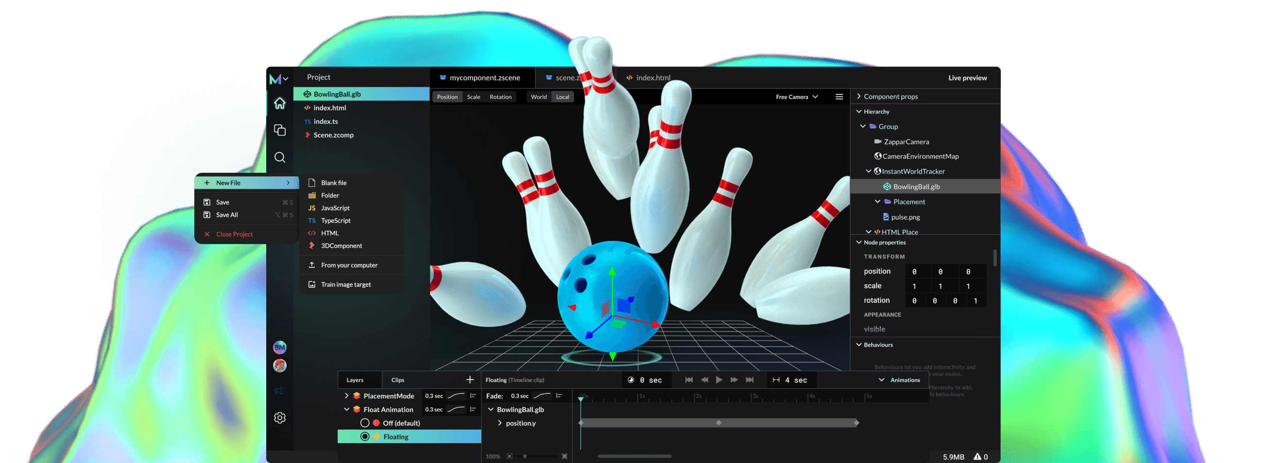
Add your map ID and see it visually come to life instantly then rapidly test and build with Mattercraft’s Live Preview feature.
Anchor & Interact
Deliver immersive 3D experiences that are persistent and respond dynamically to the user’s physical environment.
Deploy across platforms
Publish and update projects instantly to the web for iOS and Android – no app store submissions or downloads.
Fast, precise location-based AR all running in the web
Whether you’re a developer looking to create the next big location-based AR experience or a business aiming to elevate customer and employee interactions, Mattercraft's integration with Immersal and MultiSet offers unmatched flexibility and control. Map, create, and deploy immersive content seamlessly to the web.
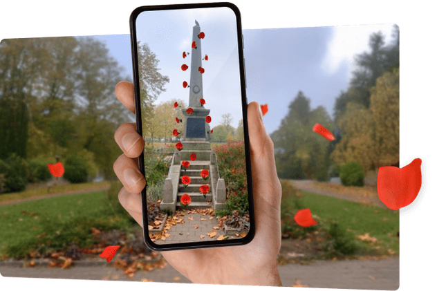
Bring Environments to Life
Create location-based AR experiences that interact with the physical world around you. Bring spaces like museums and parks to life using Mattercraft’s best in class feature set likes physics, animations and particles.
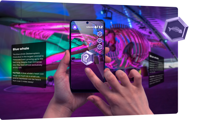
Gamified Experiences
Build city-scale scavenger hunts or stadium AR experiences that unlock exclusive digital collectibles and drive fan engagement all anchored to specific locations and delivered through the web for faster deployments.
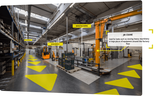
Enterprise Training
Create interactive, location-based onboarding and training scenarios. New employees can be guided through a facility, learning about key equipment or safety protocols in context and in real time.
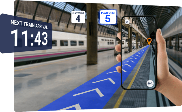
Wayfinding in Complex Spaces
Navigate large venues like an airport or hospital, where traditional maps don’t cut it. Create AR experiences that guide users with precision, overlaying directions in real time as they walk.
Unlock the power of location-based AR for Enterprise
Mattercraft’s integrations with Immersal and MultiSet empowers enterprise with secure and reliable location-based AR solutions. Businesses can enhance training, streamline navigation in complex facilities, and engage customers with interactive, real-world experiences—all while maintaining full control over map data.
Easy Deployment Across Platforms
Build once and deploy seamlessly across iOS and Android devices, reducing the need for multiple apps without the challenges of app store compliance and app management.
Complete Data Control and Ownership
Keep control of your spatial maps with a data ownership model. Host maps on your own secure servers or on-premises.
Offline and On-Device Localization
Perfect for complex environments or areas with poor connectivity, on-device localization provides a reliable AR experience that minimizes dependency on internet access.
Streamlined Development
Add your map ID and see it visually come to life instantly in Mattercraft, for easy development and placement of digital content.
No App Stores, No Delays
No waiting for app store approvals or navigating app downloads. Once you’ve built your experience, it’s instantly live on the web, available to users with the tap of a link.
Highly optimized for the web
Both Immersal and MultiSet provide maps that are highly optimized to maintain small file sizes without sacrificing detail or accuracy – perfect for running on the web.
Best-in-class Visual Positioning Systems
When it comes to location-based 3D experiences, there’s no one-size-fits-all solution. That’s why Mattercraft gives you the flexibility of two powerful VPS options in Immersal and MultiSet. Both are built to handle everything from creative brand activations to enterprise-grade spatial systems.
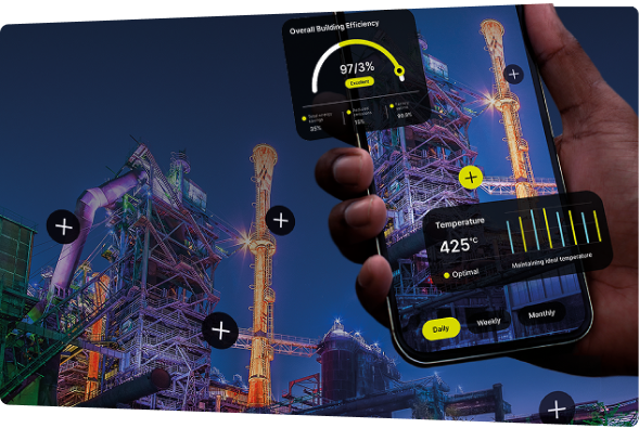
Immersal VPS
Fast, flexible, and ready to scale — Immersal offers a versatile Visual Positioning System (VPS) that provides accurate location-based data from devices in the modern world improving navigation, management, and interaction within both indoor and outdoor environments.
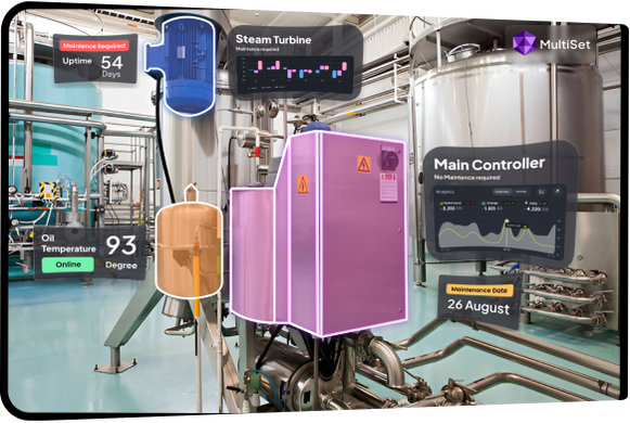
MultiSet VPS
Built for enterprise, MultiSet VPS adds high-accuracy mapping, navmesh-based wayfinding, and full data ownership to Mattercraft. Host privately, in the cloud, or on-device with encryption and compliance built in. Perfect for large or multi-level environments from campuses to factories.
FAQ
What is a Visual Positioning System (VPS)?
A Visual Positioning System (VPS) uses computer vision to determine a device’s precise position in the real world by analysing camera imagery. Unlike GPS, which relies on satellites and struggles indoors, VPS recognises visual features in the environment to anchor digital content accurately in 3D space. In Mattercraft, VPS enables you to build persistent, location-aware AR experiences that work seamlessly indoors or outdoors—perfect for everything from wayfinding and training to entertainment and enterprise workflows.
What industries use Immersal and MultiSet VPS with Mattercraft?
VPS is used across:
- Retail & marketing – interactive store experiences, product placement, scavenger hunts.
- Museums & attractions – guided tours, spatial storytelling, and AR overlays.
- Enterprise & manufacturing – indoor navigation, digital twins, safety training.
- Education & research – AR campus navigation, spatial learning environments.
The combination of Mattercraft’s no-code web deployment and enterprise VPS precision makes it suitable for nearly any sector using real-world AR.
What’s the difference between Immersal and MultiSet?
Mattercraft integrates with two complementary VPS providers:
Immersal: Ideal for developers and teams looking to quickly map and localise spaces with a simple mobile workflow. Immersal offers centimetre-level accuracy, rapid map creation via the Immersal Mapper app, and web-friendly deployment.
MultiSet: Designed for enterprise-grade applications. MultiSet supports self-hosted or on-device deployments, scan-agnostic imports (LiDAR, Matterport, Leica, etc.), object tracking (ModelSet), and navigation meshes for indoor wayfinding. It offers 6 cm accuracy, encrypted data handling, and full map ownership.
Both integrations work directly inside Mattercraft, letting you choose the right VPS for your project—whether that’s rapid deployment or deep enterprise control.
How accurate is VPS?
Visual Positioning Systems (VPS) use computer vision to locate a device in 3D space with far greater precision than GPS. Instead of relying on satellites, VPS analyses the camera feed to understand real-world surroundings — achieving centimetre-level accuracy indoors and outdoors for AR navigation, training, and spatial experiences.
Immersal VPS offers 5–15 cm precision using fast, cloud-based localisation. It’s ideal for creators and brands building interactive experiences such as wayfinding, exhibitions, and retail activations. Mapping is done quickly via the Immersal Mapper app, with results that stay stable and responsive across devices and lighting conditions.
MultiSet VPS delivers sub-6 cm accuracy through an AI-powered vision fusion pipeline built for enterprise reliability. It performs consistently across indoor and outdoor environments, supports on-premise or on-device deployment, and offers low-drift precision (≈1 cm after 60 s) — making it the choice for industrial, robotics, and large-scale navigation use cases.
Both VPS integrations in Mattercraft give you unmatched spatial precision, data control, and scalability, ensuring your AR content stays locked to the real world, wherever your users are.
How can I create my own spatial map for location-based AR experiences?
Creating a spatial map is the first step in building a location-based AR experience — and with Mattercraft, it’s simple to do using Immersal or MultiSet.
With Immersal VPS:Download the Immersal Mapper app for iOS or Android, sign up for a free account, and scan your environment using your phone or a supported 360° camera. Once uploaded to the Immersal Developer Portal, you’ll receive a unique Map ID to use directly in Mattercraft.
With MultiSet VPS:Sign up at the MultiSet Developer Portal and map your space using a LiDAR-equipped iPhone or iPad, or import existing scans from Matterport, Leica, NavVis, or E57 formats. You can also combine multiple scans into a larger MapSet for complex sites. Generate your Client ID and Map Code, then drop them into the MultiSet Anchor Group inside Mattercraft.
Both integrations let you visualise your 3D map in Mattercraft, accurately place digital content in real-world coordinates, and publish experiences instantly to the web — no app required.
What devices are supported for VPS content?
Because Mattercraft is a web-based 3D authoring and deployment tool, location-based AR experiences built with either Immersal or MultiSet VPS work seamlessly across devices — no app downloads or store submissions required.
How do Immersal and MultiSet VPS differ from Niantic’s VPS solution?
While all three offer visual positioning capabilities, Immersal and MultiSet give creators and enterprises far greater control, flexibility, and data ownership than Niantic’s closed Lightship system.
Immersal VPS lets developers create, host, and own their maps from start to finish. Using the Immersal Mapper app, you can scan environments with a smartphone or 360° camera, upload directly to your own developer account, and deploy instantly in Mattercraft — with no approval delays or third-party ownership.
MultiSet VPS goes even further, combining sub-6 cm accuracy with enterprise-grade flexibility. It supports self-hosted, private cloud, and offline (on-device) deployments, plus object tracking and navigation meshes for large-scale indoor and outdoor environments. All map data remains fully encrypted and owned by you, ensuring compliance and security.
By contrast, Niantic’s Lightship VPS requires map approval, retains data ownership, and limits hosting to its own ecosystem, making it less suitable for enterprise, industrial, or privacy-sensitive use cases.
What are the benefits of hosting and deploying location-based AR experiences to the web vs apps?
Deploying AR experiences to the web with Mattercraft using Immersal, or MultiSet VPS eliminates the friction of app downloads and app store approvals, making it the fastest, most accessible way to deliver spatial content at scale.
Build once, deploy everywhere:
With Mattercraft’s web-first architecture, you can publish an experience once and make it instantly available across iOS, Android, and desktop browsers. The same URL or QR code launches seamlessly on any device, enabling users to engage with your AR content in seconds.
Streamlined hosting and control:
Web-based deployment lets organisations integrate AR into their existing hosting infrastructure without new app builds or approval cycles. With Immersal VPS, you can publish and manage maps directly through your developer portal. MultiSet VPS extends this flexibility with self-hosted, private cloud, or on-device deployment options, giving enterprises full control over data, security, and uptime.
Faster updates and scalability:
Because Mattercraft experiences are hosted on the web, you can update content instantly without resubmitting to app stores. This makes scaling, maintaining, and iterating on large-scale AR deployments simple, fast, and cost-effective.
In short, web-based AR delivers speed, accessibility, and ownership — everything app-based solutions struggle to match..
Can I localise content on-device?
Yes! Both Immersal and MultiSet VPS support on-device localisation, allowing Mattercraft experiences to run offline without relying on cloud connectivity.
Immersal VPS lets you store and localise maps directly on the device, making it ideal for environments with limited or no internet access. Using the Immersal Mapper app, you can capture and store spatial maps that enable fast, reliable localisation even when offline — perfect for remote sites, exhibitions, and industrial settings.
MultiSet VPS extends this further with fully offline deployment options, supporting on-device, on-premise, or private cloud localisation. All maps and model data are encrypted at rest, ensuring security while maintaining sub-6 cm accuracy in real time. This makes it particularly suited to enterprise, defence, or manufacturing applications where connectivity or data privacy is critical.
With both integrations, Mattercraft empowers creators and enterprises to deliver consistent, high-precision AR experiences — anywhere, anytime, even offline.
Can I self-host location-based AR content created with Mattercraft and Immersal?
Yes — both Immersal and MultiSet VPS integrations in Mattercraft allow you to self-host your spatial maps and AR experiences, giving you full control over your data and infrastructure.
With Immersal VPS:You can export and host maps and experiences on your own cloud environment, maintaining ownership of your data while managing access securely. This flexibility is ideal for organisations that want to integrate location-based AR into existing web systems or internal networks, without relying on third-party hosting.
With MultiSet VPS:You gain even deeper control. MultiSet supports private cloud, on-premise, and on-device deployments, with encrypted data storage and full export capabilities. Enterprises can align hosting with internal compliance, IT, or security policies while maintaining sub-6 cm accuracy and 24/7 uptime.
Whether you’re deploying a branded activation, training simulation, or industrial navigation system, self-hosting through Mattercraft ensures your maps, content, and data stay entirely yours.
How secure is my data when using Immersal or MultiSet VPS?
Both VPS providers prioritise data privacy and control:
Immersal allows creators to host maps independently, ensuring no third-party access to location data. MultiSet offers full encryption at rest, private cloud or on-device deployment, and map export controls for compliance with ISO, GDPR, or enterprise security frameworks.
Mattercraft itself never stores raw visual map data — it simply references your VPS provider credentials, keeping your environments safe and under your control.
Can I map locations at both night and day?
Yes, both Immersal and MultiSet VPS support mapping the same location under different lighting conditions to ensure reliable localisation at any time of day.
With Immersal VPS:
You can create separate maps for daytime and nighttime environments using the Immersal Mapper app. Each map can then be uploaded to your developer portal and selected dynamically in Mattercraft, ensuring accurate tracking whether your AR experience runs in bright sunlight or artificial lighting.
With MultiSet VPS:
You can capture multiple lighting conditions within a single environment and manage them as individual maps or combine them into a MapSet. MultiSet’s AI-driven vision fusion system helps handle environmental variations such as lighting changes, reflections, and shadows, maintaining sub-6 cm accuracy even across dynamic conditions.
Whether you’re scanning for daytime exhibitions or evening events, both VPS solutions in Mattercraft give you flexibility and precision, no matter the light conditions.
What's the maximum size of a space that can be scanned?
Both Immersal and MultiSet VPS can handle anything from small rooms to vast multi-level venues.
Immersal VPS has been proven to scale across tens of thousands of square metres, with large sites like Helsinki’s 85,000 m² Mall of Tripla successfully mapped. For extensive areas, you can create multiple overlapping maps and stitch them together for seamless localisation across zones.
MultiSet VPS offers virtually unlimited scalability, supporting massive environments through its MapSet system. You can merge multiple maps, manage floors, or connect indoor and outdoor areas into a unified coordinate space. This makes it ideal for enterprise-scale deployments like campuses, warehouses, and large event spaces.
Does VPS support multiple maps at the same time in the same space?
Yes — both Immersal and MultiSet support using multiple maps simultaneously within the same environment.
Immersal VPS allows you to load and switch between maps dynamically, making it easy to combine indoor and outdoor areas or maintain different levels of detail for specific sections. You can also update individual rooms or areas without rescanning the entire site, keeping localisation accurate and efficient.
MultiSet VPS takes this further with its MapSet architecture, enabling multiple maps to coexist within one unified coordinate system. This supports multi-floor navigation, partial updates, and real-time transitions — perfect for complex or evolving spaces across varied environments.
Can I use VPS for Object Tracking?
Not directly — Immersal VPS and MultiSet VPS are designed for environmental localisation, not tracking individual moving objects.
Immersal focuses on anchoring content to fixed spatial environments — ideal for persistent AR experiences that rely on stable surroundings.
MultiSet, however, includes a ModelSet feature that enables object tracking, editing, and updates for static or semi-fixed objects within a mapped environment. This makes it suitable for scenarios like asset monitoring, maintenance training, or digital twins where objects remain in known positions.
